Tomorrow A wet start in the southwest, but most other areas dry tomorrow morning with some sunshine in the midlands and north, and frost clearing. Rain will spread northeastwards through the afternoon, turning heavy in places with local spot flooding possible, but much of Ulster will stay dry until evening apart from scattered showers. Becoming very windy in parts of Munster and south Leinster with possibly severe winds in coastal fringes. Rain will turn to snow in places especially later in the day. Top temperatures just 5 to 8C.Outlook Thursday: A cold and cloudy day with scattered outbreaks of rain, turning more persistent across the south of the country during the afternoon /evening; highs of 6 to 8 degrees in moderate southwest breezes. Rain continuing in the south overnight, may turn to snow in parts of south-Leinster. Otherwise cold and frosty.Friday: Rain mixed with sleet and snow will continue to develop over Leinster and parts of Munster during the day. Connacht, Ulser and west Munster will remain largely dry. Highest temperatures of 4 to 7 degrees. Further rain and snow in the east and southeast overnight, cold and frosty elsewhere. Saturday: Last of the rain and snow gradually clears from the east during Saturday; most other parts of the country dry, and brightening everywhere during the day. After a cold and frosty start temperatures will rise to between 6 and 8 degrees. Cold and frosty again overnigh
Doctor Shivering wrote: » BBC news 24 has tonight's rain extensively turning to snow for a time across a huge swathe of the midlands across even to Dublin Large dumps on high ground by the looks of it
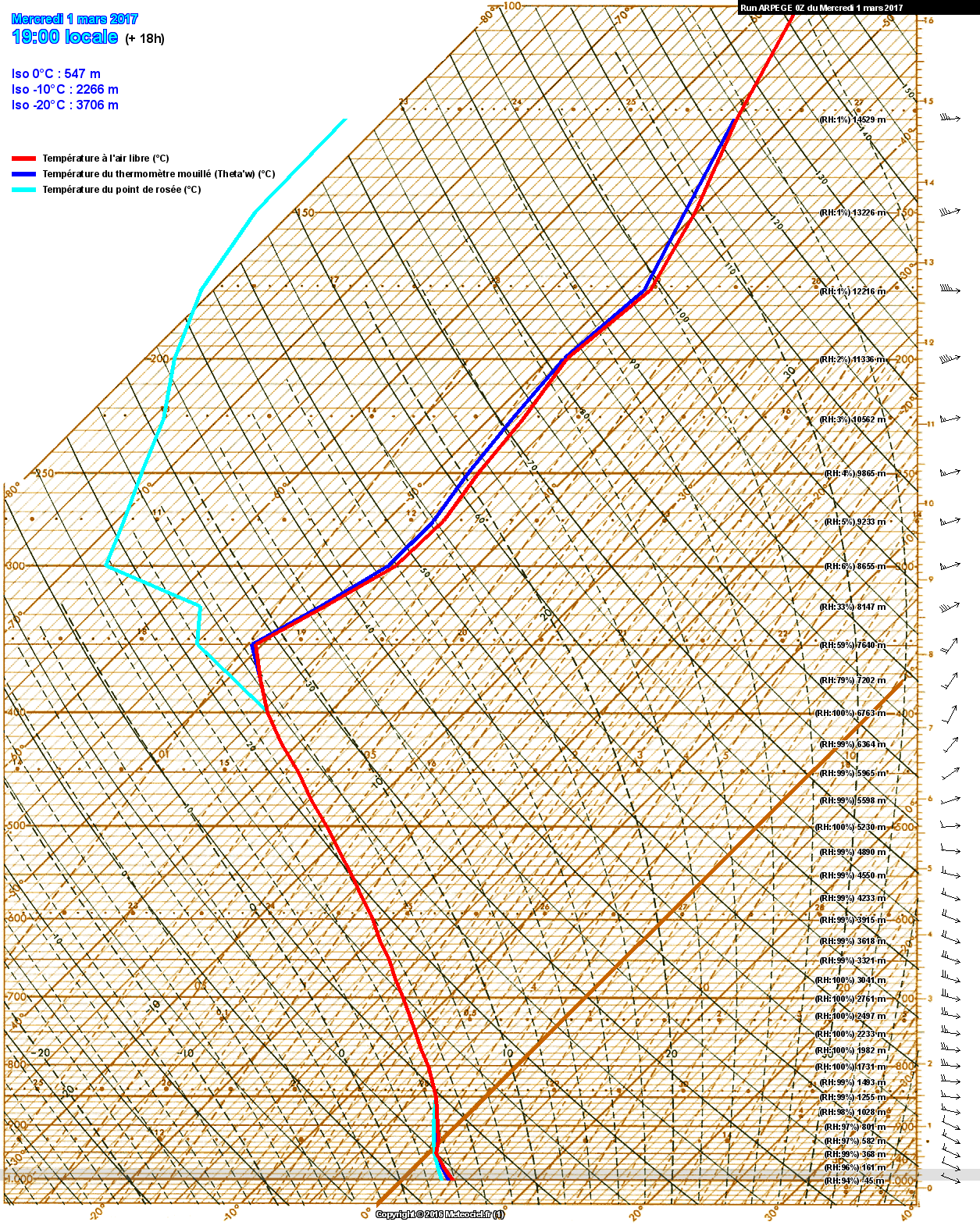
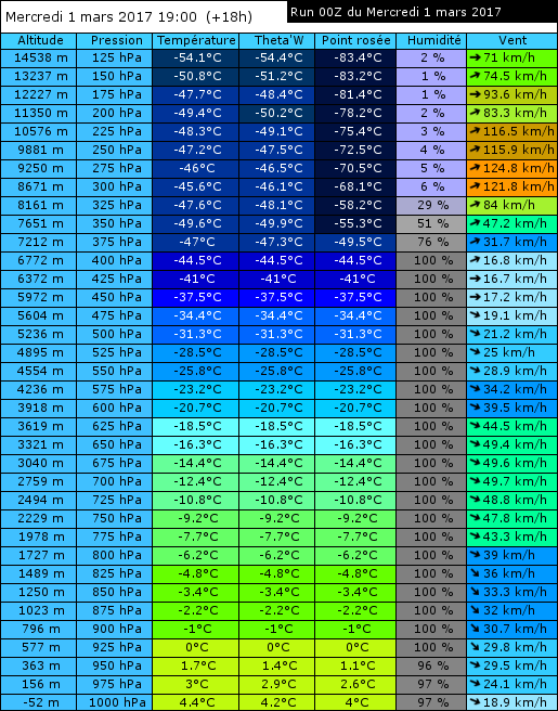
Gaoth Laidir wrote: » Still looks like sleet for low levels. The latest Arpege sounding for around Mullingar during the heaviest precip later shows no scope for evaporative cooling as the wet-bulb temperature is well above zero in the lowest few hundred metres.
highdef wrote: » So based on that, would the snowline be looking to be around 500m or so, lying snow that is (for Mullingar in this case)? It seems at odds with some of the forecasts but then again, one or more of them are going to be wrong if they are forecasting different things. Would you give an estimate as to at what height one would want to be to see proper falling snow, even if not sticking? I know there are many attributes to take into account such as distance from the sea, latitude, etc. Lets say east midlands, as that looks like the area most likely to get any snow, if any.
March - Rather warm, wet and sunny. April - Warm, dry and sunny. May - Very cool, dull and wet.
JCX BXC wrote: » Perhaps one of the most rapid changes of Weather I've seen in a while is at Cork airport.
Buffalobill29 wrote: » Is it going to be cold this evening with showers on low ground and some wet snow above 200m? Specifically for the east?