Advertisement
If you have a new account but are having problems posting or verifying your account, please email us on hello@boards.ie for help. Thanks :)
Hello all! Please ensure that you are posting a new thread or question in the appropriate forum. The Feedback forum is overwhelmed with questions that are having to be moved elsewhere. If you need help to verify your account contact hello@boards.ie
Hi all! We have been experiencing an issue on site where threads have been missing the latest postings. The platform host Vanilla are working on this issue. A workaround that has been used by some is to navigate back from 1 to 10+ pages to re-sync the thread and this will then show the latest posts. Thanks, Mike.
Hi there,
There is an issue with role permissions that is being worked on at the moment.
If you are having trouble with access or permissions on regional forums please post here to get access: https://www.boards.ie/discussion/2058365403/you-do-not-have-permission-for-that#latest

Samuel Beckett Bridge under construction in Holland

1457910

Comments

  • Moderators, Motoring & Transport Moderators Posts: 14,088 Mod ✭✭✭✭monument


    BrianD wrote: »
    One thing is certainly the same. The complete inability of DCC to put up directional signs. I see no evidence of a single signpost going up to sign this major route. Dublin - the city with no road signs.

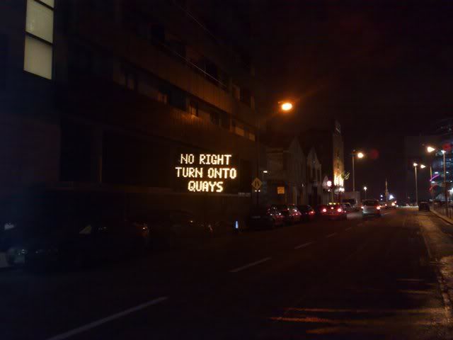
    I know you mean normal signs, but DCC have in the last week or two installed electronic signs on some major routes which did not previous have them (North Quays etc) -- I'm sure these could be used to help with the bus gate too once it's back.


  • Registered Users, Registered Users 2 Posts: 368 ✭✭Roryhy


    Open to traffic from 7am 11th Dec- according to AA roadwatch
    http://www.aaroadwatch.ie/news/story.asp?ID=1504

    The Samuel Beckett Bridge Officially Opening - Fri 11th Dec
    Updated: 09/12/2009 16:46:35
    The Samuel Beckett Bridge officially opens at 7am on Fri 11th Dec.
    This will link Guild Street on the northside of Dublin City with Sir John Rogerson’s Quay on the southside. To facilitate the opening ceremony, which takes place at the Bridge tomorrow, Gárdai will close Sir John Rogerson’s Quay from 3.15pm to 4.30pm between the Cardiff lane and Lime St. jct. Motorists are advised to take alternative routes during this time.


  • Registered Users, Registered Users 2 Posts: 19,340 CMod ✭✭✭✭Davy


    http://www.dublincity.ie/Press/PressReleases/PressReleasesDecember2009/Pages/CurtainraisedasSamuelBeckettBridgereaches%E2%80%98Endgame%E2%80%99on10thDecember2009.aspx
    Lord Mayor Cllr Emer Costello will formally cut the ribbon on Dublin City Council’s Samuel Beckett Bridge at 15.45hrs on Thursday 10th December 2009. It will officially open to traffic from 07.00 hrs on Friday 11th December 2009


  • Closed Accounts Posts: 13,992 ✭✭✭✭gurramok


    Heart wrote: »
    It's an interesting map... there's no right turn from Cardiff Lane on SJR Quay... the only way to get to the section between Cardiff Lane and Forbes St. seems to be by coming over the bridge itself... or am I reading that wrong???

    Isn't this the turn the 74, 74a buses take???

    Went for a walk down there a few minutes ago. It appears to me that the map is wrong for one of the 'banned' turns. There is still a lane provided to turn right from Cardiff Lane onto SJR quay, alongside a new lane for the bridge.
    Tarabuses wrote: »
    Looking at the map it gives the impression that Misery Hill IS two way as far as Hibernian Road.

    Hate to break it to you but Misery Hill is still a bomb site less than 24hrs before the bridge opening so it does not figure at all in th etraffic management.

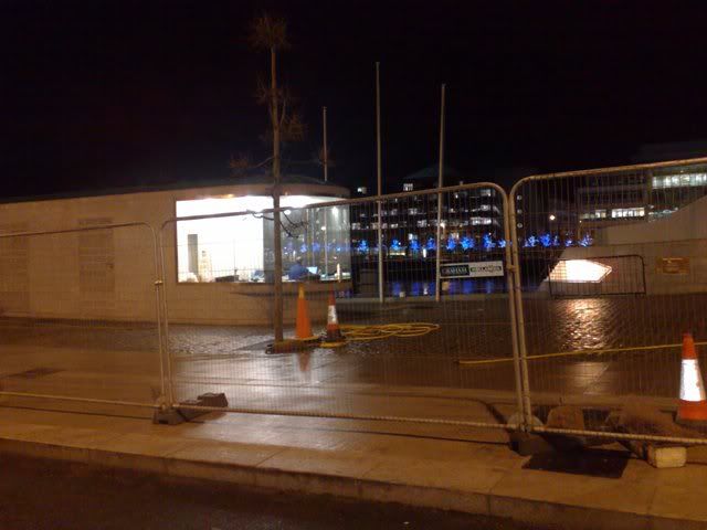
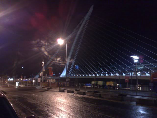
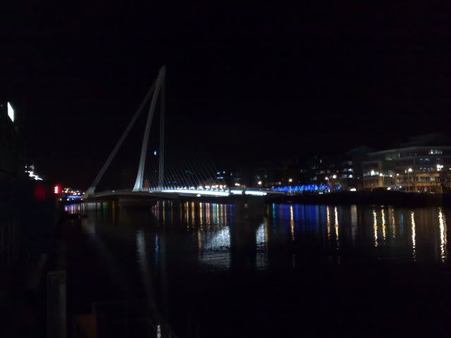
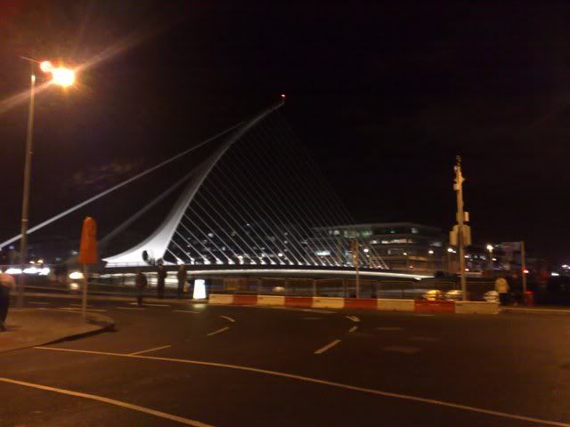
    Here is a few pics I took tonight.

    The booth for controlling the bridge:
    09122009632_.jpg

    The bridge at 45degrees angle
    09122009634_.jpg

    And from a distance taken on the southside.
    09122009635_.jpg


  • Registered Users Posts: 5,674 ✭✭✭obi604


    One thing I noticed, so when im on the northside on guild street and I want to head towards the southside, looks like I cant drive straight over the bridge, can only take a left or right , but thats not detailed in the freeflow map.however, on the road markings on guild street, they only have left and right arrows just before the bridge , no straight on . anybody have any news on this ?


  • Advertisement
  • Closed Accounts Posts: 13,992 ✭✭✭✭gurramok


    That wouldn't make sense if that was the case obi604, it defeats the purpose of the bridge at relieving the Custom House bottleneck. In that case its diverting hell of alot traffic down CHQ from the Custom House for a right hand turn onto the bridge.
    That would affect me as well!

    I walked over it tonight, its a natural wonder :P Didn't take notice the Guild st end as you say, anyone else did?

    Also, there is indeed a restriction on right hand turn from Cardiff Lane onto SJR quay. Thing is, the top half of Misery Hill is still blocked off with construction junk so unless they clear all that overnight, Misery Hill will still be blocked and there would be no way for local southside traffic to get onto SJR quay area east of Cardiff Lane

    Guess we'll know in the morning when its all officially opened to traffic.

    10122009645_.jpg

    No right hand turn onto SJR quay.
    10122009644_.jpg

    Also, there are camera's everywhere which is a good thing to stop vandals.


  • Closed Accounts Posts: 1,735 ✭✭✭Irish and Proud


    dowlingm wrote: »
    Source?

    http://www.railusers.ie/campaigns/extendthedart/what_is_the_drp.php on www.railusers.ie

    The key element is the Interconnector. The Interconnector is a tunnel to connect Heuston station with a new station at Spencer Dock, thus connecting Heuston with the Northern and Western lines. This tunnel will allow a massive increase in capacity by eliminating the current capacity restriction through the city centre. It will include stations at High Street, Stephen's Green, Pearse and Spencer Dock. Connections to Luas Green line can be made at Stephen's Green, connections to Luas Red line at Heuston and Spencer Dock. Passengers may also change at Pearse station for services to Maynooth/Dunboyne and Bray/Greystones. The tunnel will built sufficiently large enough to allow for the use of double decker trains and will be designed from the outset for trains of up to 12 coaches in length.

    ...now, I'm not sure if that's part of the official interconnecter plan quoted, or is it a P11 variation - also, if it's the former, I'm not sure of the date upon which the above was stated.

    Regards!


  • Registered Users, Registered Users 2 Posts: 1,600 ✭✭✭00112984


    BrianD wrote: »

    One thing is certainly the same. The complete inability of DCC to put up directional signs. I see no evidence of a single signpost going up to sign this major route. Dublin - the city with no road signs.


    Spotted new directional signs on Grand Canal St. (Macken St. junction) pointing to "Samuel Beckett Bridge". No mention of where this leads to or any route numbers of course.


  • Closed Accounts Posts: 422 ✭✭CCSL


    Here are some pics.
    IMGP8942.JPG
    IMGP9031.JPG
    IMGP8996.JPG
    IMGP9007.JPG

    More over on my blog - http://blog.ccsl.biz


  • Closed Accounts Posts: 13,992 ✭✭✭✭gurramok


    Did anyone notice when walking on the bridge how wobbly vibration wise it was?

    God help what its like when the traffic starts crossing tomorrow!


  • Advertisement
  • Registered Users, Registered Users 2 Posts: 78,490 ✭✭✭✭Victor


    obi604 wrote: »
    One thing I noticed, so when im on the northside on guild street and I want to head towards the southside, looks like I cant drive straight over the bridge, can only take a left or right , but thats not detailed in the freeflow map.however, on the road markings on guild street, they only have left and right arrows just before the bridge , no straight on . anybody have any news on this ?
    They would be the existing markings.

    http://www.irishtimes.com/newspaper/breaking/2009/1210/breaking84.htm
    Samuel Beckett bridge opens

    The opening ceremony of Dublin's newest bridge, named after Nobel laureate Samuel Beckett, took place today.

    The iconic structure stretches 120 metres across the capital’s River Liffey from Guild Street on the northside to Sir John Rogerson’s Quay on the southside.

    Designed by Spanish architect Santiago Calatrava, the bridge takes the shape of the Irish harp with cable-stay ‘strings’.

    Actor Barry McGovern performed Beckett excerpts at the ribbon-cutting ceremony as the Waiting for Godot author’s niece Caroline Murphy, nephew Edward Beckett and hundreds of Dubliners looked on.

    Ms Murphy said her uncle would have been amazed by the 40 million euro creation.

    “He was a very, very unassuming man and I think he would have been quite overcome.

    “I can see the tears in his eyes now — he probably wouldn’t have turned up to the opening but I think he would be very, very overcome by emotion,” she said.

    “It’s wonderful that Seamus Heaney came and I’m quite amazed that there are so many people here.

    “I thought there would have been only a sprinkling of people in the know but I think Dublin has taken this bridge to its heart.”

    The Samuel Beckett Bridge’s steel superstructure was built at a Rotterdam shipyard before making a week-long sea voyage to Ireland in May.

    It can rotate to an angle of 90 degrees between an open and closed position to allow boats to travel along the river and will also be able to accommodate Luas trams.

    Lord Mayor of Dublin Emer Costello said the 48 metre-high bridge was a central part of the capital’s transport infrastructure.

    “The Beckett Bridge will improve traffic circulation, public transport and the pedestrian environment in the city centre,” she added.

    The structure is the second Calatrava bridge in the capital after the James Joyce bridge.

    The architect said he was deeply honoured to have given Dublin two signature designs.

    “It is rare that an artist is able to contribute to the blueprint of such a historically rich city,” he said.

    “Working on the James Joyce Bridge I developed a deep affinity for the people of Dublin, and I wanted my next bridge to celebrate that connection.”

    PA

    http://www.irishtimes.com/newspaper/images/2009/1211/frontpageimage.jpg?ts=1260493639

    http://www.irishtimes.com/newspaper/images/2009/1211/1224260513695_1.jpg

    http://www.irishtimes.com/newspaper/ireland/2009/1211/1224260513695.html
    OLIVIA KELLY

    DUBLIN’S €60 MILLION Samuel Beckett Bridge, designed by internationally renowned architect Santiago Calatrava, will open to traffic this morning.
    The 120-metre long, 48-metre high bridge spans the river Liffey from Sir John Rogerson’s Quay near Macken Street on the south side to Guild Street at the site of the new National Convention Centre on the north side.

    It was one of two bridges commissioned from Calatrava by Dublin City Council 10 years ago. The other, the James Joyce Bridge, opened at Blackhall Place near Heuston Station on Bloomsday, June 16th, 2003.

    The new bridge was projected in 1998 to cost £10 million, but the costs ultimately rose to almost €60 million.

    Designed to represent a harp on its side the cable-stayed bridge was made in the Netherlands and arrived in Dublin last May.

    It had a difficult introduction to the city, with two failed attempts to put it in place on the river due to high winds and generally poor weather.

    However, it opened slightly ahead of schedule, having been due to open in early 2010.

    The bridge will be capable of rotating through an angle of 90 degrees to facilitate maritime traffic.

    It has four traffic lanes, cycle tracks and footpaths and will be capable of accommodating a Luas track.

    It was opened to pedestrians yesterday by Lord Mayor of Dublin Emer Costello.

    Relatives of Samuel Beckett attended the event as did actor Barry McGovern, known internationally for his Beckett performances, and poet Seamus Heaney.


  • Registered Users Posts: 73 ✭✭walzer


    I'm abroad and missing all the fun. Let us know how the traffic goes tomorrow.


  • Registered Users, Registered Users 2 Posts: 9,342 ✭✭✭markpb


    walzer wrote: »
    I'm abroad and missing all the fun. Let us know how the traffic goes tomorrow.

    I was on a bus on Amiens St at 8.20am and didn't notice any difference at all (given that it's Friday). DCC have recently put up new VMSs showing the number of free parking spaces in private carparks and, while they were indicating that the bridge was open, I didn't see any signs telling anyone how to get there so I guess it will take some time for people to find out where it is and figure out new routes.

    The traffic yesterday looks terrible though :D


  • Closed Accounts Posts: 3,418 ✭✭✭Jip


    They need to sort out the lanes on Grand Canal Street where the new lights are at the Macken Street junction. There's a couple of parking spaces just before the new lights heading towards the city so what's been happening since they were put in is that traffic waiting for the filter to turn right onto Macken Street hold up traffic trying to go straight if there's cars parked in the spaces leading to bloody tailbacks, there's no room for traffic to go straight as the parked cars and the right turning traffic hold it up. The 2 or 3 spaces that are there need to be removed, otherwise traffic is going to be pretty bad there.


  • Registered Users, Registered Users 2 Posts: 411 ✭✭Wibbler


    It has four traffic lanes, cycle tracks and footpaths and will be capable of accommodating a Luas track.

    Wonder how that would work given that the current LUAS uses overhead line for power and the whole bridge pivots.


  • Registered Users, Registered Users 2 Posts: 15,107 ✭✭✭✭loyatemu


    Wibbler wrote: »
    Wonder how that would work given that the current LUAS uses overhead line for power and the whole bridge pivots.

    that's a damn good question, though its unlikely to be an issue as there are no plans on the books for a Luas line over the bridge anymore. Overhead catenary would really ruin the look of the bridge too.


  • Closed Accounts Posts: 20,009 ✭✭✭✭Run_to_da_hills


    Wibbler wrote: »
    Wonder how that would work given that the current LUAS uses overhead line for power and the whole bridge pivots.
    Passengers will just have to get out and push it over the bridge. :D


  • Registered Users, Registered Users 2 Posts: 21,487 ✭✭✭✭Alun


    Wibbler wrote: »
    Wonder how that would work given that the current LUAS uses overhead line for power and the whole bridge pivots.
    There are, I believe, trams that use on-board rechargeable batteries to get them across short distances like this, or to negotiate complex road junctions where catenaries would be difficult to build and/or look messy. Don't know whether such a system could be added to existing Luas's though.


  • Registered Users Posts: 223 ✭✭candyman


    how does one get from the o2 across this bridge with no left turn from North wall quay?

    Seems you cant come from Sherriff St either with no left turn from Sherriff onto Guild!

    anyone know whats going on here?


  • Registered Users, Registered Users 2 Posts: 734 ✭✭✭Tarabuses


    Jip wrote: »
    They need to sort out the lanes on Grand Canal Street where the new lights are at the Macken Street junction. There's a couple of parking spaces just before the new lights heading towards the city so what's been happening since they were put in is that traffic waiting for the filter to turn right onto Macken Street hold up traffic trying to go straight if there's cars parked in the spaces leading to bloody tailbacks, there's no room for traffic to go straight as the parked cars and the right turning traffic hold it up. The 2 or 3 spaces that are there need to be removed, otherwise traffic is going to be pretty bad there.

    I thought it was illegal to park in a junction?


  • Advertisement
  • Closed Accounts Posts: 3,418 ✭✭✭Jip


    It's not parking in a junction, it's parking in a designated space at a junction, it's all legal until the designated spaces are removed.


  • Registered Users, Registered Users 2 Posts: 15,107 ✭✭✭✭loyatemu


    candyman wrote: »
    how does one get from the o2 across this bridge with no left turn from North wall quay?

    Seems you cant come from Sherriff St either with no left turn from Sherriff onto Guild!

    anyone know whats going on here?

    was down there at lunchtime and there were lots of cars turning left off the quays onto the bridge - didn't see the signage on that side so don't know if that turn is illegal on the ground. There were also cars turning right from Macken Street onto SJR Quay which definitely seems to be a banned turn.


  • Registered Users, Registered Users 2 Posts: 4,859 ✭✭✭Poxyshamrock


    Any pics? :)


  • Registered Users, Registered Users 2 Posts: 78,490 ✭✭✭✭Victor


    http://www.irishtimes.com/newspaper/breaking/2009/1211/breaking4.htm
    Samuel Beckett Bridge opens

    OLIVIA KELLY

    Dublin's €60 million Samuel Beckett Bridge, designed by internationally renowned architect Santiago Calatrava, opened to traffic this morning.

    The 120-metre long, 48-metre high bridge spans the river Liffey from Sir John Rogerson’s Quay near Macken Street on the south side to Guild Street at the site of the new National Convention Centre on the north side.

    It was one of two bridges commissioned from Calatrava by Dublin City Council 10 years ago. The other, the James Joyce Bridge, opened at Blackhall Place near Heuston Station on Bloomsday, June 16th, 2003.

    The new bridge was projected in 1998 to cost £10 million, but the costs ultimately rose to almost €60 million.

    Designed to represent a harp on its side the cable-stayed bridge was made in the Netherlands and arrived in Dublin last May.

    It had a difficult introduction to the city, with two failed attempts to put it in place on the river due to high winds and generally poor weather.

    However, it opened slightly ahead of schedule, having been due to open in early 2010.

    The bridge will be capable of rotating through an angle of 90 degrees to facilitate maritime traffic.

    It has four traffic lanes, cycle tracks and footpaths and will be capable of accommodating a Luas track.

    Motorists have been advised that there is no right-turn from the bridge on either side of the river and there is no left-turn from North Wall Quay onto the north side of the bridge.

    It was opened to pedestrians yesterday by Lord Mayor of Dublin Emer Costello.

    Relatives of Samuel Beckett attended the event as did actor Barry McGovern, known internationally for his Beckett performances, and poet Seamus Heaney.

    http://www.irishtimes.com/newspaper/breaking/images/2009/1211/244457_1.jpg?ts=1260534796

    http://www.independent.ie/multimedia/archive/00436/beckett1_indo_436108t.jpg
    http://www.independent.ie/multimedia/archive/00436/beckett3_indo_436110t.jpg
    http://www.independent.ie/multimedia/archive/00436/beckett2_indo_436109t.jpg

    http://www.independent.ie/national-news/an-iconic-new-string-to-laureate-becketts-bow-1971234.html
    An iconic new string to laureate Beckett's bow

    By Paul Melia

    Friday December 11 2009

    WHEN Samuel Beckett crashed into 'terrible Victoria Bridge' in Dublin's Ringsend 60 years ago it gave him nightmares for years.

    So he would have appreciated the irony yesterday when, 40 years to the day he became a Nobel laureate, the citizens of his home city of Dublin gathered to watch the opening of a bridge named in his honour.

    Dublin Lord Mayor Emer Costello officially opened the €60m Samuel Beckett Bridge, which links Guild Street on the northside with Sir John Rogerson's quay on the south.

    "No one would be more surprised and humbled than the man himself," actor Barry McGovern told the crowd.

    The ceremony was attended by Nobel Prize winner Seamus Heaney, the 'Waiting for Godot' author's niece Caroline Murphy, nephew Edward Beckett and hundreds of others.

    Ms Murphy said her uncle would have been amazed by the bridge named in his honour.

    "I can see the tears in his eyes now -- he probably wouldn't have turned up to the opening but I think he would be very, very overcome by emotion.

    "It's wonderful that Seamus Heaney came and I'm quite amazed that there are so many people here."

    The Samuel Beckett Bridge is positioned between the Sean O'Casey Bridge and the East Link Bridge. Stretching 120 metres across the capital's River Liffey, it was designed by Spanish architect Santiago Calatrava.

    It takes the shape of the Irish harp with cable-stay 'strings', and was built in Rotterdam before making a week-long sea voyage to Ireland in May.

    - Paul Melia

    Irish Independent


  • Registered Users, Registered Users 2 Posts: 363 ✭✭The Swordsman


    candyman wrote: »
    how does one get from the o2 across this bridge with no left turn from North wall quay?

    Seems you cant come from Sherriff St either with no left turn from Sherriff onto Guild!

    anyone know whats going on here?

    A cynic (not me, you inderstand) might think that perhaps they want people to use another bridge down nearer the o2. Why else would they ban left turns, a cynic would say.

    I can't see personally why they would want that unless they were worried about the East Link TOLL Bridge getting jealous. ;);)


  • Registered Users Posts: 223 ✭✭candyman


    loyatemu wrote: »
    was down there at lunchtime and there were lots of cars turning left off the quays onto the bridge - didn't see the signage on that side so don't know if that turn is illegal on the ground. There were also cars turning right from Macken Street onto SJR Quay which definitely seems to be a banned turn.


    There are defo "no left turn" signs at the bridge on the north wall quay so all the cars must be making illegal turns there. Cant understand the logic behind the no left hand turn onto the bridge from there, seems completely at odds with the aim of stopping cars clogging up the quays up nearer town.

    Does anyone know how this bridge is supposed to be accessed (legally) from the northside?


  • Registered Users, Registered Users 2 Posts: 363 ✭✭The Swordsman


    candyman wrote: »
    There are defo "no left turn" signs at the bridge on the north wall quay so all the cars must be making illegal turns there. Cant understand the logic behind the no left hand turn onto the bridge from there, seems completely at odds with the aim of stopping cars clogging up the quays up nearer town.

    Does anyone know how this bridge is supposed to be accessed (legally) from the northside?

    Down Amiens Street, turn left at the IFSC and then turn right (I know:mad::mad:) at the bridge. Why you would want to do that when it is quicker to cross at the Matt Talbot and make your way down the south quays is another story.

    Can you get to it from the five lamps by heading down Seville Place?


  • Registered Users, Registered Users 2 Posts: 15,107 ✭✭✭✭loyatemu


    Can you get to it from the five lamps by heading down Seville Place?

    Yes AFAIK, so the only area you can't easily access it from is East Wall and the Port. I can't see any reason for that no-left restriction other than to preserve toll revenue for the East-Link.


  • Registered Users, Registered Users 2 Posts: 78,490 ✭✭✭✭Victor


    I think there is a difference between preserving toll revenue for the East-Link and ending up with a situation where the Eastlink is empty and the Beckett is congested.


  • Advertisement
  • Registered Users Posts: 223 ✭✭candyman


    loyatemu wrote: »
    Yes AFAIK, so the only area you can't easily access it from is East Wall and the Port. I can't see any reason for that no-left restriction other than to preserve toll revenue for the East-Link.

    This seems mental. Just spoke to Dublin City Council to see the logic behind the no left hand turn from North Wall Quay onto the bridge. Basically he said it was the residents who insisted on it back in the planning phase as they didn't want trucks/lorries coming across the bridge. I mentioned the port tunnel at this point. He also said the bridge was not designed to alleviate traffic on the quays, it was more for pedestrians and cyclists!

    Head engineer is Pasty Gorman (016708648).


  • Closed Accounts Posts: 4,858 ✭✭✭paulm17781


    candyman wrote: »
    He also said the bridge was not designed to alleviate traffic on the quays, it was more for pedestrians and cyclists!

    That would explain the 4 lanes on it. :rolleyes: :eek:


  • Registered Users, Registered Users 2 Posts: 363 ✭✭The Swordsman


    Victor wrote: »
    I think there is a difference between preserving toll revenue for the East-Link and ending up with a situation where the Eastlink is empty and the Beckett is congested.

    Solution: Get rid of the toll!!

    Then people will use both.


  • Registered Users, Registered Users 2 Posts: 363 ✭✭The Swordsman


    candyman wrote: »
    This seems mental. Just spoke to Dublin City Council to see the logic behind the no left hand turn from North Wall Quay onto the bridge. Basically he said it was the residents who insisted on it back in the planning phase as they didn't want trucks/lorries coming across the bridge. I mentioned the port tunnel at this point. He also said the bridge was not designed to alleviate traffic on the quays, it was more for pedestrians and cyclists!

    Head engineer is Pasty Gorman (016708648).

    I thought trucks were already banned from going down the quays.


  • Registered Users, Registered Users 2 Posts: 21,034 ✭✭✭✭Stark


    I thought trucks were already banned from going down the quays.

    In a half arsed fashion. Only 5-axle trucks are banned and even then it's easy enough to get an exemption.


  • Closed Accounts Posts: 7,221 ✭✭✭BrianD


    A cynic (not me, you inderstand) might think that perhaps they want people to use another bridge down nearer the o2. Why else would they ban left turns, a cynic would say.

    I can't see personally why they would want that unless they were worried about the East Link TOLL Bridge getting jealous. ;);)

    I fail to see how having these turns in place would detract from the east link. At the moment for people crossing the river both options exist.

    the only people really discomoded are those living/working immediately north or south of the bridge in the Docklands. The various no right/left turns really affect them.

    It would seem to me though it's not obvious because DCC haven't put up any signage that the bridge is designed for people travelling from further out across the city rather than for local access.


  • Advertisement
  • Closed Accounts Posts: 1,735 ✭✭✭Irish and Proud


    Solution: Get rid of the toll!!

    Then people will use both.

    I agree that the East Link toll is a pain in the a*se - however, you may wait till 2014 I think - when the toll concession expires!

    Regards!


  • Posts: 16,720 ✭✭✭✭ [Deleted User]


    candyman wrote: »
    He also said the bridge was not designed to alleviate traffic on the quays, it was more for pedestrians and cyclists!

    Head engineer is Pasty Gorman (016708648).

    Raised elsewhere, but as a cyclist I wasn't sure whether to observe the 'no left' turns or not. Pretty difficult if that is indeed the intention to use the bridge properly.


  • Registered Users, Registered Users 2 Posts: 5,112 ✭✭✭Blowfish


    Dónal wrote: »
    Raised elsewhere, but as a cyclist I wasn't sure whether to observe the 'no left' turns or not. Pretty difficult if that is indeed the intention to use the bridge properly.
    Not just that, but going from Macken Street onto the bridge (i.e. turning right), I didn't see any obvious way to even get onto the cycle track.

    Then again, it wouldn't have done me much good getting on the track as they've once again managed to use the incredibly stupid design where the cycle track doesn't merge properly with the lanes at the end of the bridge, but instead dumps you at right angles to them. Also, the cycle track is seperated from the traffic by a barrier, but not seperated from the footpath at all, meaning even on day 1 pedestrians were wandering all over it.

    Ah well, yet another "cycle facility" to be ignored.


  • Registered Users, Registered Users 2 Posts: 369 ✭✭Empire o de Sun


    I used the bridge today,

    Firstly, it is welcomed loads to have another crossing point.

    But

    Getting to it is not easy as there are so many turning restrictions, and when you cross you can't get to your street cos of more turning restrictions.

    So after my trial run today I will be going back to driving through town.

    Also, has anyone seen any direction signs telling motorists and cyclists how to get to it?

    It seem funny that they can spend €60 million on a new bridge and not put up one proper direction sign for Ringsend or Spencer Dock, or City North or South. It is like a hidden route (if you don't need to turn).

    I saw one finger post sign at the Five Lamps, and it looked so cheap small and tacky, and was already spinning around the lamp post in the wind. I only saw it cos I was stopped at the lights.

    The signing and route integration into the local streets is really poor. The say it's for pedestrians and cyclists. But if you cycle aren't you supposed to obey the no right and no left turns too.

    And yet another cycle facility designed by someone who doesn't cycle.


  • Registered Users, Registered Users 2 Posts: 2,283 ✭✭✭Chorcai


    Alun wrote: »
    There are, I believe, trams that use on-board rechargeable batteries to get them across short distances like this, or to negotiate complex road junctions where catenaries would be difficult to build and/or look messy. Don't know whether such a system could be added to existing Luas's though.

    I bet you any amount that the Luas doesnt have it and needs to be upgraded at a huge ammount and because of that it wont happen.


  • Advertisement
  • Registered Users Posts: 375 ✭✭Maldini2706


    Dónal wrote: »
    Raised elsewhere, but as a cyclist I wasn't sure whether to observe the 'no left' turns or not. Pretty difficult if that is indeed the intention to use the bridge properly.

    You should observe the no left signs, it was really dangerous there yesterday because when the lights went green for inbound traffic to go straight on people were turning left onto what was also a green man for pedestrians heading in the direction of Beresford Place, the same danger would be in place for cyclists.


  • Closed Accounts Posts: 13,992 ✭✭✭✭gurramok


    It seem funny that they can spend €60 million on a new bridge and not put up one proper direction sign for Ringsend or Spencer Dock, or City North or South. It is like a hidden route (if you don't need to turn).

    I live near Ringsend and know the routes to get around using the bridge as I use it from South-East to North-West direction and vice versa so no restrictions for me. From which direction where you trying to travel from and travel to?

    I was on it today also, lots of cars using that turn left from North Wall quay onto the bridge. I wouldn't blame them either if they were heading to the South-East as the detour brings you to the worst of the congestion in town and it is tempting for them to hop over the short bridge in a manner of seconds to slice many minutes off their journey time!
    Its a dangerous situation, there are camera's there so would they trace the drivers down?

    Regarding Misery Hill, it is half opened, bottom half is open while the top half is closed so you have to go through side streets to get to SJR quay eastside. Noticed new traffic lights going up too around here.

    Also. DCC have not sequenced the lights from one end of the bridge to the other. I was first car in queue at south end and when the lights went green outside the Ferryman, the lights on exiting the bridge went red within about 5 seconds of me moving off so traffic pile up on the bridge! (well done DCC :mad:)

    Only way to avoid that is to speed so here we are again seen DCC encouraging drivers to speed to avoid stop start scenario's in such a short distance.:mad:


  • Closed Accounts Posts: 7,221 ✭✭✭BrianD


    Similar to the complaint about cycle lanes it is quite apparent that those in the roads department don't drive either.

    The Samuel Beckett is another example of a great idea that isn't signed properly. Hence nobody is clear at what the purpose of the bridge, how it fits into Dublins routes and it is no wonder that people are complaining about it just days after it opened. The other great idea was the college green busway that is so badly signed it is no wonder it is destined for failure.

    It would be great id somebody in DCC could improve signage in the city that are clearly visible and the right size. Overhead gantry signage would be welcome on a lot of city streets. It is time to for them to accept that their ring route signs are an abject failure that nobody but them can understand (and even if you did you would need to have binoculars to read the signs).

    It is my understanding that the Samuel Beckett bridge is part of a routeway that brings traffic on the NCR across the river via Saville Row, Guild St. and then the bridge. You wouldn't know as DCC depend on motorists having local knowledge and second guess the route.

    I also believe that the SB bridge will also be part of a north south cycle way. The bridge has good cycle way but the routing either side of the river is only in the planning permission stage.

    I drove over the bridge yesterday and it is a fabulous structure.


  • Registered Users, Registered Users 2 Posts: 5,337 ✭✭✭dowlingm


    Alstom make battery powered Citadis vehicles - 20 in service in Nice. Having them would mean being able to put a LUAS down a street where overhead would be unacceptable for heritage reasons.

    Alternatively, rather than use catenary on the swing piece solid bar conductors could be used, with vehicle momentum carrying the LUAS from one section to the other as is done when trains are moving from one voltage type to another.


  • Registered Users Posts: 2,281 ✭✭✭mackerski


    BrianD wrote: »
    It is my understanding that the Samuel Beckett bridge is part of a routeway that brings traffic on the NCR across the river via Saville Row,

    That'd be a bit out of the way. Seville Place?


  • Closed Accounts Posts: 13,992 ✭✭✭✭gurramok


    Also, the bridge had its first beggar(of foreign extraction) I saw today. Camera's all over the place and begging is supposed to be illegal :mad:
    mackerski wrote: »
    That'd be a bit out of the way. Seville Place?

    Yes. Have the residents of Seville Row been consulted about the impending huge traffic volumes because of the bridge?

    Alot of children do be out and about in that area so drivers beware.


  • Registered Users, Registered Users 2 Posts: 78,490 ✭✭✭✭Victor


    gurramok wrote: »
    Also, the bridge had its first beggar(of foreign extraction) I saw today. Camera's all over the place and begging is supposed to be illegal :mad:
    Passive begging is no longer illegal.


  • Registered Users, Registered Users 2 Posts: 5,301 ✭✭✭Snickers Man


    Walked over the bridge the night before it was opened to traffic and drove over it for the first time today.

    First off: it is a beautiful structure and one which, in aesthetic terms, I am glad we shelled out the money to pay for. A public monument such as that improves the city for everyone.

    But.....this is not just a monument, it is supposed to be a functional item. One that has a utilitarian purpose, and on first examination, I am at a loss to know what it is.

    I drove from the south inner city to the airport. Down Macken St and over the bridge. No right turn on to the north quays. OKayeee. Go straight on and take the next right. Encouraged by the prominent filter lane encouraging everybody to do so. Then you come to a big dead end. I was not the only person so deceived. Everybody else that made that turn ended up doing a youeee and heading back to the quays.

    Coming back from the airport I came down the east wall road and right on to the quays. No LEFT turn on to the bridge. Helloo!! So I turned right and ended up in Seville Place which from what I can gather after consulting a map is the ONLY place you can drive to heading from south to north. A very residential area and hardly a suitable place for a major traffic artery.

    All of this is compounded by the god awful signage or rather the complete lack of same. What is it with the "Ah sure Jaysus everyone knows that" attitude of the people with responsibility for our roads?

    Tomorrow I will take out the old gluaistean and check out a few more absurdities. Can one turn right for example, from East Wall Road into Sherrif St and from there left into Guild St? If one can't then there would seem to be no alternative to driving through heavily residential areas to make use of the bridge.

    I must confess to having little sympathy for people who say of the streets in which they live that the very people who pay for their upkeep, ie those who tax their cars legitimately, should not be allowed use them, but at the same time, if there are wide thoroughfares in the area then these SHOULD be the ones which motorists should be encouraged to use. It's only common sense.

    Please let this wonderful new structure not become another victim of blinkered governmental small mindedness.


  • Registered Users, Registered Users 2 Posts: 7,588 ✭✭✭Bluetonic


    So I turned right and ended up in Seville Place which from what I can gather after consulting a map is the ONLY place you can drive to heading from south to north. A very residential area and hardly a suitable place for a major traffic artery.
    Seville Place already is a major traffic artery, it's the natural route to take when going south from the end of the NCR, and as such the bridge, Seville Place and Portland Row area a direct link from the NCR to the south city and visa versa.


  • Closed Accounts Posts: 301 ✭✭crocro


    But.....this is not just a monument, it is supposed to be a functional item. One that has a utilitarian purpose, and on first examination, I am at a loss to know what it is.
    The bridge connects the north and south IFSC. It allows for journeys from the south and southeast of the bridge to destinations on the north and northwest of the bridge and vice versa.
    I drove from the south inner city to the airport. Down Macken St and over the bridge. No right turn on to the north quays.
    The direct route to the airport is to continue up Seville Place and on to the NCR and the N1/M1 to the airport. If you want to use the tunnel you can cross the east link.

    The bridge is hardly meant to encourage cross city airport commuters to enter the city centre. Through traffic does nothing for the city - it just brings noise and air pollution and congestion. There are two routes for southside airport drivers - the M50 from the SW and the eastlink/port-tunnel from the SE.
    Can one turn right for example, from East Wall Road into Sheriff St and from there left into Guild St?
    No, you cross the eastlink.
    I must confess to having little sympathy for people who say of the streets in which they live that the very people who pay for their upkeep, ie those who tax their cars legitimately, should not be allowed use them, but at the same time, if there are wide thoroughfares in the area then these SHOULD be the ones which motorists should be encouraged to use. It's only common sense.
    Taxes associated with driving will raise about three times the amount spent on roads in 2010 and about 10 times the amount spent in 2011. Driving taxes are used to raise general revenue for the state. There is no policy that revenue raised from drivers should be spent on drivers and no policy that wide streets in a city should always be filled with car traffic.


  • Advertisement
Advertisement