Advertisement
If you have a new account but are having problems posting or verifying your account, please email us on hello@boards.ie for help. Thanks :)
Hello all! Please ensure that you are posting a new thread or question in the appropriate forum. The Feedback forum is overwhelmed with questions that are having to be moved elsewhere. If you need help to verify your account contact hello@boards.ie
Hi all,
Vanilla are planning an update to the site on April 24th (next Wednesday). It is a major PHP8 update which is expected to boost performance across the site. The site will be down from 7pm and it is expected to take about an hour to complete. We appreciate your patience during the update.
Thanks all.

Seen & Found

2456732

Comments

  • Registered Users Posts: 6,700 ✭✭✭Mountainsandh


    Yes there's probably loads undiscovered.

    There's a story in my locality, that says that a number of heavily inscribed stones were found by a farmer on his land. In the words of my older friend, who was a young boy at the time, "there was lots of writing on them". The farmer didn't want the men from the town to come down and take over his field, so with the help of local men, and some machinery, they dug up the field and shoved the whole lot down in the whole, breaking some in the process, and covered them well up again. My friend says that he was there, but can't remember where the spot is at all. Some years later some archeologists are said to have come around as they had heard about it, but they could not locate anything.

    My friend's versions are likely to change a bit every time he tells the story, but I should ask him to tell me again. He loves the old stories, but tends to romance or improvise a bit I'm sure, depending on what he remembers that day. He's not that old either, but just took notice of everything that was happening around.
    He remembers when the electricity was switched on in our area fairly well too, such a great story !


  • Moderators, Science, Health & Environment Moderators Posts: 5,218 Mod ✭✭✭✭slowburner


    There are a couple of photos of the stone mentioned above in this article
    before the inscription was translated.
    The full report is here.
    http://www.wessexarch.co.uk/reports/62511/speke-keeill-mount-murray-hotel


  • Registered Users Posts: 728 ✭✭✭pueblo


    Hi, I'd like to get some opinions on the attached pics showing pieces of pottery found in a river. I'm hoping it's late bronze age!

    Some photos attached

    Thanks


  • Registered Users Posts: 728 ✭✭✭pueblo


    pueblo wrote: »
    Hi, I'd like to get some opinions on the attached pics showing pieces of pottery found in a river. I'm hoping it's late bronze age!

    Some photos attached

    Thanks

    Don't all reply at once...:-)

    Anyone with any opinions on my sherds?


  • Registered Users Posts: 128 ✭✭olly_mac


    I am no pottery expert but the sherds here look too 'compact' to be Late BA to me. They remind me more of medieval ware. I may be wrong though!! :)


  • Advertisement
  • Moderators, Science, Health & Environment Moderators Posts: 5,218 Mod ✭✭✭✭slowburner


    pueblo wrote: »
    Hi, I'd like to get some opinions on the attached pics showing pieces of pottery found in a river. I'm hoping it's late bronze age!

    Some photos attached

    Thanks

    I'm no expert either, but I would hazard a guess at post medieval, maybe C.16th at the very latest, probably more recent.
    I'd base this guess partly on the fact that the sherd edges are hardly worn.
    If they had been tossed about in the river for 500 odd years, they'd be as rounded as beach pebbles.
    If they were bronze age, they would be very unlikely to survive in a river at all. 2,500 years of abrasion by a river would leave only dust.
    They are almost certainly handmade; if that tells us anything.
    The rings have been scored while the vessels were on a potter's wheel, rather than the earlier technique of impressing cord in the wet clay.

    The fragments might date from different periods too - could you tell us a bit about the circumstances of their discovery?

    Below is a (fairly) similar sherd from the later bronze age for comparison.
    One important thing to note is that the gloss on the sherd below is a patina from handling and cleaning, it's not a glaze. The glaze on your sherds looks more like a salt glaze which was popular from the C.17th.

    I hope someone with a bit of expertise in this area helps out, because they are interesting looking sherds.

    209386.jpg


  • Registered Users Posts: 728 ✭✭✭pueblo


    slowburner wrote: »
    I'm no expert either, but I would hazard a guess at post medieval, maybe C.16th at the very latest, probably more recent.
    I'd base this guess partly on the fact that the sherd edges are hardly worn.
    If they had been tossed about in the river for 500 odd years, they'd be as rounded as beach pebbles.
    If they were bronze age, they would be very unlikely to survive in a river at all. 2,500 years of abrasion by a river would leave only dust.
    They are almost certainly handmade; if that tells us anything.
    The rings have been scored while the vessels were on a potter's wheel, rather than the earlier technique of impressing cord in the wet clay.

    The fragments might date from different periods too - could you tell us a bit about the circumstances of their discovery?

    Below is a (fairly) similar sherd from the later bronze age for comparison.
    One important thing to note is that the gloss on the sherd below is a patina from handling and cleaning, it's not a glaze. The glaze on your sherds looks more like a salt glaze which was popular from the C.17th.

    I hope someone with a bit of expertise in this area helps out, because they are interesting looking sherds.

    209386.jpg


    Thanks for the replies. No expert here, mho only.

    They sherds were all collected from the river nore.

    There is a natural gravel break in the river and this seems to catch alot of pottery sherds after heavy flood.
    When the river levels drop I often pick up pieces and have a good collection

    The picture you post is interesting as I have spent hours searching pottery identification sites etc to try and find something similar to that 'ribbed' design! It is quite similar to my pieces, source?

    My theory is that these pieces are buried in silt/mud over thousands (?) of years and sit as disposed rubbish buried beneath the river Nore only to be dislodged by a combination of recent flood works in Kilkenny and subsequent heavy flooding causing the sherds to drift downstream.

    I know there was a strong medieval pottery industry in Kilkenny near what is now the MacDonagh Junction shopping centre. I believe the river probably holds a vast amount of debris from multiple periods.

    I have four sherds with that same design. The spacing between the grooves is almost identical. Some of are quite thick approx 17mm implying quite a large vessel? Also the reason the sherds aren't heavily 'rolled' or water worn is explained possibly by the fact they were only recently dislodged?

    Thanks again to you both for the replies.


  • Moderators, Science, Health & Environment Moderators Posts: 5,218 Mod ✭✭✭✭slowburner


    pueblo wrote: »
    Thanks for the replies. No expert here, mho only.

    They sherds were all collected from the river nore a few miles downstream of Kilkenny city - yes it is a city :-)-

    There is a natural gravel break in the river and this seems to catch alot of pottery sherds after heavy flood.
    When the river levels drop I often pick up pieces and have a good collection

    The picture you post is interesting as I have spent hours searching pottery identification sites etc to try and find something similar to that 'ribbed' design! It is quite similar to my pieces, source?

    My theory is that these pieces are buried in silt/mud over thousands (?) of years and sit as disposed rubbish buried beneath the river Nore only to be dislodged by a combination of recent flood works in Kilkenny and subsequent heavy flooding causing the sherds to drift downstream.

    I know there was a strong medieval pottery industry in Kilkenny near what is now the MacDonagh Junction shopping centre. I believe the river probably holds a vast amount of debris from multiple periods.

    I have four sherds with that same design. The spacing between the grooves is almost identical. Some of are quite thick approx 17mm implying quite a large vessel? Also the reason the sherds aren't heavily 'rolled' or water worn is explained possibly by the fact they were only recently dislodged?

    Thanks again to you both for the replies.
    The pottery industry near the MacDonagh junction is the most probable source of the sherds. Is that the Highhays pottery works?
    8,000 medieval sherds were found at No.1, Irishtown. See pdf below.

    Would it be worth while to pay a visit to Rothe House?


  • Registered Users Posts: 43 richban


    I also found a pdf listing all the caves in the area with photographs and diagrams, and analysing them one at a time in great precision, if that's of interest to anyone lurking or yourself.
    http://www.gsi.ie/NR/rdonlyres/80C42EE2-C9D1-4888-9628-5AD3A09C8A93/0/Waterford_section2_site_reports_part1.pdf

    That GSI report on the waterford caves is fantastic thanks - I was horrified to read

    'Cave surveys done in 1990 by Moldywarps Speleo Group show
    there were three other caves (Through Cave, Tip Cave, Maze Cave) but these have been buried with earth and rocks by the landowner in farm works on the top of the knoll between 1990 and 1998. However the 2011 visit indicated further recent landscaping, including the entrance slope to Well Cave.

    theres a photo inside of landscaping which seem to have destroyed 2 no. cave entrances - 'Tip Cave' and 'Maze Cave'- by a farmer - why has he not been prosecuted? This is an outrage


  • Moderators, Science, Health & Environment Moderators Posts: 5,218 Mod ✭✭✭✭slowburner


    richban wrote: »
    That GSI report on the waterford caves is fantastic thanks - I was horrified to read

    'Cave surveys done in 1990 by Moldywarps Speleo Group show
    there were three other caves (Through Cave, Tip Cave, Maze Cave) but these have been buried with earth and rocks by the landowner in farm works on the top of the knoll between 1990 and 1998. However the 2011 visit indicated further recent landscaping, including the entrance slope to Well Cave.

    theres a photo inside of landscaping which seem to have destroyed 2 no. cave entrances - 'Tip Cave' and 'Maze Cave'- by a farmer - why has he not been prosecuted? This is an outrage
    All (?) these caves are registered National Monuments.
    Perhaps it would be worth bringing the matter to the attention of the county heritage officer.
    There is also a very active group associated with mining heritage along the Copper Coast -
    http://www.coppercoastgeopark.com
    I'd imagine they'd be interested.


  • Advertisement
  • Registered Users Posts: 6,700 ✭✭✭Mountainsandh


    Richban, I thought the same at first, but it has to be said that some of the landscaping he did was probably to close off holes/skylights that could have been dangerous to kids and cattle. Farmers here farm actively, it's more important to them than a cave that nobody is coming to look at anyway, and it's mentioned in one of the reports that some stalagtites or some such were destroyed by kids, so I'm sure with possibly a few kids hanging around the land, the farmer was just after safety. Imagine if you were left on your own with a cave on your land, and dangerous spots, and nobody from govt ever coming to even look at it, you might end up doing the same.

    It's a long time since, and I wonder if anyone has kept an eye on all these caves, and if anyone is planning more investigations.

    It is said that some could have chambers that have not been found/opened... Paleolithic Deise fellow waiting to be discovered ? ;)


  • Registered Users Posts: 6,700 ✭✭✭Mountainsandh


    slowburner wrote: »
    All (?) these caves are registered National Monuments.
    Perhaps it would be worth bringing the matter to the attention of the county heritage officer.
    There is also a very active group associated with mining heritage along the Copper Coast -
    http://www.coppercoastgeopark.com
    I'd imagine they'd be interested.

    It's not right to be leaving someone in a potentially dangerous situation though, I suppose if it was me I would be kicking up a fuss with whoever on those grounds.
    When a castle on somebody's grounds is about to crumble down, does the heritage crowd send their own crowd to work on making it safe ?
    I think I have seen a thread about that somewhere on boards actually...


  • Moderators, Science, Health & Environment Moderators Posts: 5,218 Mod ✭✭✭✭slowburner


    It's not right to be leaving someone in a potentially dangerous situation though, I suppose if it was me I would be kicking up a fuss with whoever on those grounds.
    When a castle on somebody's grounds is about to crumble down, does the heritage crowd send their own crowd to work on making it safe ?
    I think I have seen a thread about that somewhere on boards actually...

    A landowner has a right to make his or her property safe, but not to destroy a National Monument.
    Other owners fenced off the entrances rather than bulldozing them.

    Fencing them off is conservation - bulldozing the entrance is not.

    The landowner who filled in the entrance is liable to pay for any remedial work.


  • Registered Users Posts: 6,700 ✭✭✭Mountainsandh


    I know and agree, it's not right. He might have tried the fencing off before unsuccessfully.

    Either way he should be stopped and there should really be more investigations done down this way, that's for sure. So many interesting things that could potentially be discovered. They might start with redating the bones up in the Nat. Mus. ! surely that's not too costly.


  • Registered Users Posts: 728 ✭✭✭pueblo


    slowburner wrote: »
    The pottery industry near the MacDonagh junction is the most probable source of the sherds. Is that the Highhays pottery works?
    8,000 medieval sherds were found at No.1, Irishtown. See pdf below.

    Would it be worth while to pay a visit to Rothe House?

    Haven't heard of the Highhays pottery works, may well be...

    PDF is interesting will digest later, thanks.

    and yes a visit to Rothe house or Kilkenny Archeological Society may be in order..

    Will update with anything further on the sherds


  • Registered Users Posts: 43 richban


    Thanks for tip off -

    I just sent an email to Waterford County Council Heritage officer Bernadette Guest (bguest@waterfordcoco.ie) - 3 cave entrances blocked up - deliberately or otherwise since the 1990 survey and levelling works done as recently as 2011 - my god, what a great little country!


  • Registered Users Posts: 3,023 ✭✭✭Meathlass


    pueblo wrote: »
    Hi, I'd like to get some opinions on the attached pics showing pieces of pottery found in a river. I'm hoping it's late bronze age!

    Some photos attached

    Thanks

    Hi OP,

    These are all Medieval sherds, mostly Dublin Type Ware, some may be Dublin Type Coarse Ware but can't tell just from photos. They may also be locally made Kilkenny Ware which would be local variations of the Dublin Type Ware. There also seems to be a piece of Glazed Red Earthenware there as well. You also have one base which is nice. If you can get your hands on Clare McCutcheon's book on the excavations from Woodquay The Medieval Pottery from the Waterfront Excavations at Wood Quay, Dublin (Medieval Dublin Excavations, 1962-81) it has lots of great photos in it. Age wise you're looking at 13th to late 14th century and 14th century on for the Glazed Red Earthenware.


  • Registered Users Posts: 6,700 ✭✭✭Mountainsandh


    richban wrote: »
    Thanks for tip off -

    I just sent an email to Waterford County Council Heritage officer Bernadette Guest (bguest@waterfordcoco.ie) - 3 cave entrances blocked up - deliberately or otherwise since the 1990 survey and levelling works done as recently as 2011 - my god, what a great little country!

    Did you notice on most reports, it says "not commercially viable", so I'd say straight away when a report like that comes back, it gets shoved away in a drawer.

    edit : oh, and keep us updated and well done.


  • Moderators, Science, Health & Environment Moderators Posts: 5,218 Mod ✭✭✭✭slowburner


    Did you notice on most reports, it says "not commercially viable", so I'd say straight away when a report like that comes back, it gets shoved away in a drawer.

    edit : oh, and keep us updated and well done.
    'Not commercially viable' for what, do you think?


  • Registered Users Posts: 728 ✭✭✭pueblo


    Meathlass wrote: »
    Hi OP,

    These are all Medieval sherds, mostly Dublin Type Ware, some may be Dublin Type Coarse Ware but can't tell just from photos. They may also be locally made Kilkenny Ware which would be local variations of the Dublin Type Ware. There also seems to be a piece of Glazed Red Earthenware there as well. You also have one base which is nice. If you can get your hands on Clare McCutcheon's book on the excavations from Woodquay The Medieval Pottery from the Waterfront Excavations at Wood Quay, Dublin (Medieval Dublin Excavations, 1962-81) it has lots of great photos in it. Age wise you're looking at 13th to late 14th century and 14th century on for the Glazed Red Earthenware.

    Many thanks for your reply. I will indeed try and source a copy of Clare McCutcheons book.

    I have a lot more sherds, probably 100 or so of similar type pieces, I think it would be worth having someone local look at them.

    Most interesting, and thanks again.


  • Advertisement
  • Registered Users Posts: 3,023 ✭✭✭Meathlass


    Pueblo, sent you a PM


  • Registered Users Posts: 6,700 ✭✭✭Mountainsandh


    I don't know Slowburner, my memory is a bit patchy right now, but I think the link referred to a speleology club (sorry bit lazy here anglicising the French word ...:o), so maybe not suitable to commercialise in that context, or in a more tourist oriented manner, like the Mitchelstown Cave, no ?

    edit : double checked and my wording was wrong it's generally said of the caves that they are :
    not really suitable for general promotion or access.

    And other than a brief mention of sports cavers I don't know where I got the speleology thing, maybe I just romanced that in my head at the sight of the men in yellow hard hats :D


  • Registered Users Posts: 316 ✭✭Simon.d


    Thought I'd start a thread for people to post interesting earthworks and other anomalies that's they've noted on the satellite data made freely available by Bing & Google.

    Of note is Bing's very recent release of imagery, that provides a level of detail of the Irish landscape that has never been seen before, and thus in my mind provides a real opportunity for archaeological discovery...

    The easiest was to share this information is to use Bing's "Share" option, which provides a link to the satellite location being viewed. It's a button to the top right of the map pane.

    Google provides a similar option "Link" in the top right of the Left hand pane, denoted by a chain icon.

    To start the ball rolling I'd be interested to hear opinions on these Earthworks to the North of Ballymoon Castle: http://binged.it/OfscZ8 They are catalogued in the NMS, but there's no real desciption, only that they exist..


  • Registered Users Posts: 1,454 ✭✭✭bogwalrus


    looks to me like remains of a town. v.cool!


  • Moderators, Science, Health & Environment Moderators Posts: 5,218 Mod ✭✭✭✭slowburner


    Great idea for a thread SD.
    Perhaps it should not be confined solely to satellite imagery: let's not forget the wealth of aerial photography, and historical mapping to correlate/cross reference sites of potential interest.


  • Registered Users Posts: 316 ✭✭Simon.d


    bogwalrus wrote: »
    looks to me like remains of a town. v.cool!

    It looks very settlement like... I also think you can potentially see three phases of Anglo-Norman settlement on that image...

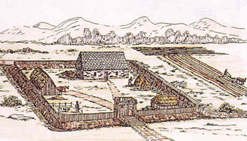
    Earliest being the moated site to the north (the square section of trees..) May have looked something like this back in the day:
    Moated-site-1.jpg

    Then they may have moved onto the larger potentially fortified enclosure as the settlement prospered... The blacked area in the neighbouring field would imply to me that this enclosure continues a bit to the West, so could be 10 or 12 acres enclosed altogether...

    And finally the stone castle was built... Castle is associated with the Templars, who apparently never finished the fortress potentially owing to the Order's demise in the early 1300s.. So how to link them in I'm not sure.. You'd assume the castle was contemporary and associated with the earthworks to some degree or other....

    There seems to have been some level of settlement in the area in the 1500s, as mercator includes "B.Moone" on his map of Carlow from that time http://www.jpmaps.co.uk/mapimages/originals/37297.jpg .. But whether that is the present day Ballymoon (A good distance to the West) or these Earthworks, I've no idea...

    I've no Access to to 1650 Civil Survey, nor Down survey maps of the area, so would love if someone could shed some light from that perspective for me..

    slowburner wrote: »
    Perhaps it should not be confined solely to satellite imagery: let's not forget the wealth of aerial photography, and historical mapping to correlate/cross reference sites of potential interest.
    Completely Agree!


  • Registered Users Posts: 2,593 ✭✭✭Sea Sharp


    Out of curiosity is there any infra-red satellite images of Ireland. There was a fascinating BBC documentary recently about how they combined infra-red images with other images to spot archaeological sites in Egypt.
    link
    Or does this depend on the type of soil/ building materials used and hence won't work for Ireland?


  • Registered Users Posts: 316 ✭✭Simon.d


    Lots going on around Cashel.....

    No idea what I'm looking at in this one.. No listing of the earthworks on the Monument Database, though there are two standing stones listed in and around them.. There's a rectilinear enclosure and some very strong linear earthworks... .. Any ideas?
    http://binged.it/Ouo1uu


    There's this one: http://binged.it/OupKAb

    Also this close to Tipp Town: http://binged.it/Oupp06 , listed as a Barrow...
    To the South of which is this: http://binged.it/Ous3Tz What are the circular features?


  • Registered Users Posts: 419 ✭✭bawn79


    Really great stuff - didnt realise this level of detail was available. A lot of ireland wasnt covered on google earth and i dont think the os website has the same level of detail and archaeology.ie can be a bit clunky to zoom around with.


  • Advertisement
  • Registered Users Posts: 5,504 ✭✭✭tac foley


    The Bing imagery is pretty much at least five years, maybe seven, out of date. I just checked the railway in my backyard and it the previous version - rebuilt in 2007.

    Of course, when you are looking for archeology, that really doesn't make that much never mind.

    tac


Advertisement