Advertisement
If you have a new account but are having problems posting or verifying your account, please email us on hello@boards.ie for help. Thanks :)
Hello all! Please ensure that you are posting a new thread or question in the appropriate forum. The Feedback forum is overwhelmed with questions that are having to be moved elsewhere. If you need help to verify your account contact hello@boards.ie
Hi all,
Vanilla are planning an update to the site on April 24th (next Wednesday). It is a major PHP8 update which is expected to boost performance across the site. The site will be down from 7pm and it is expected to take about an hour to complete. We appreciate your patience during the update.
Thanks all.

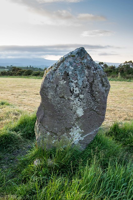
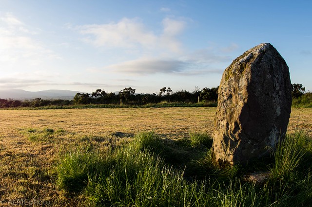
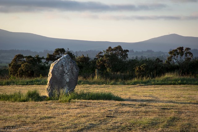
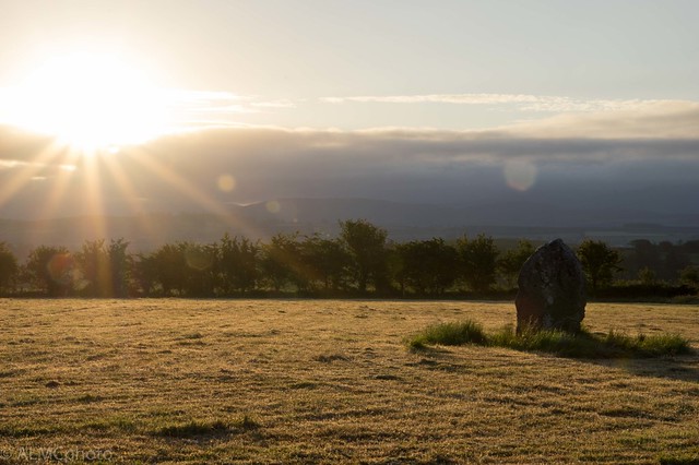
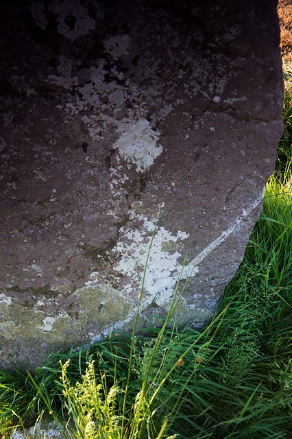
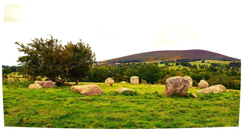
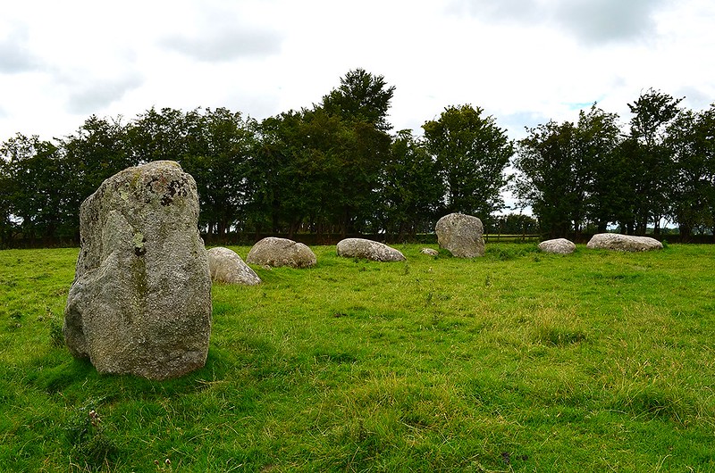
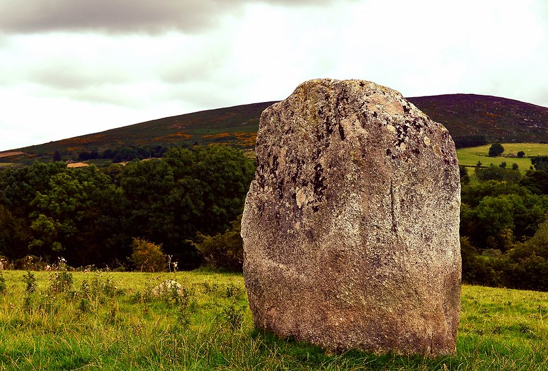
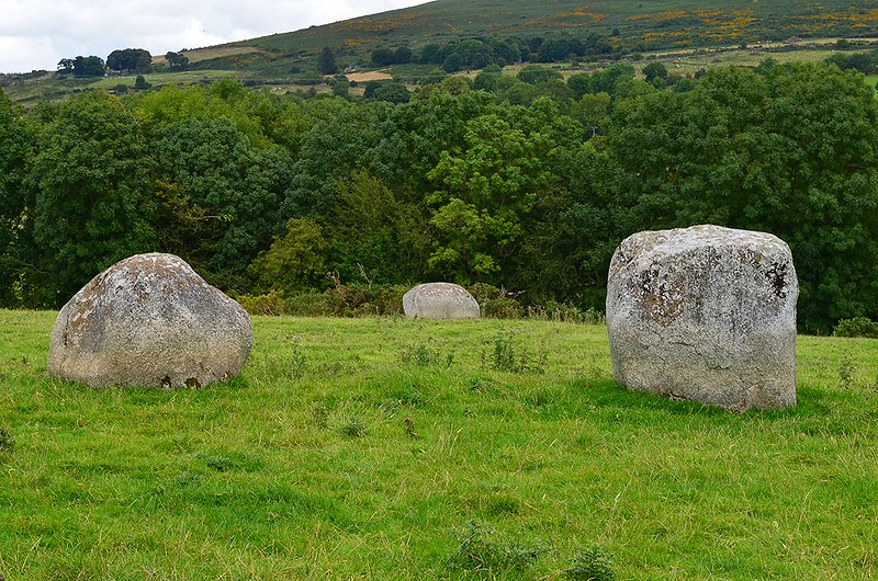
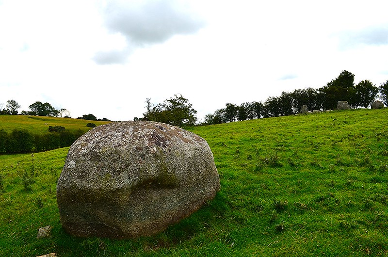
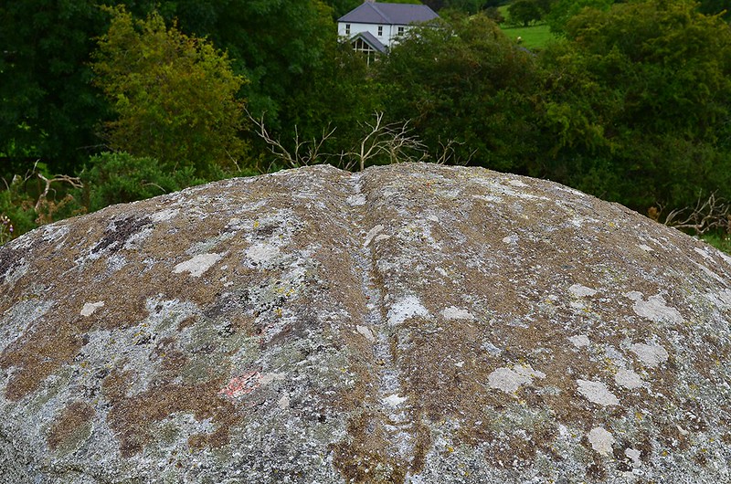
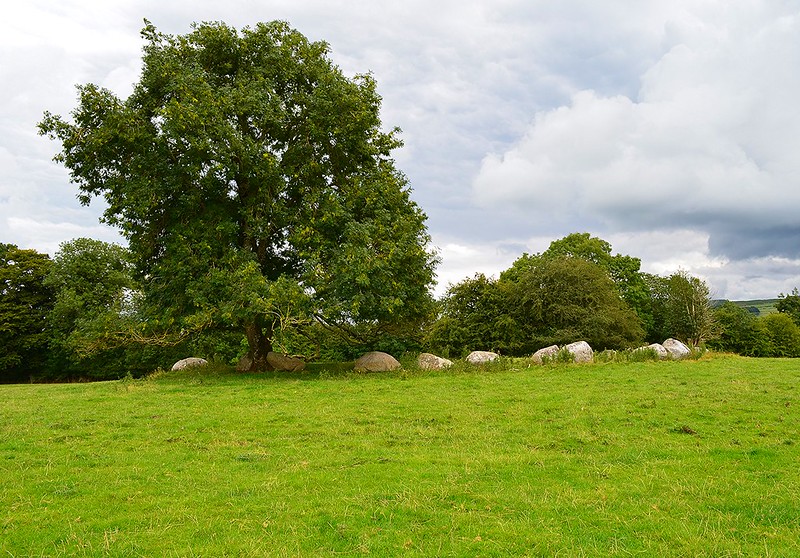
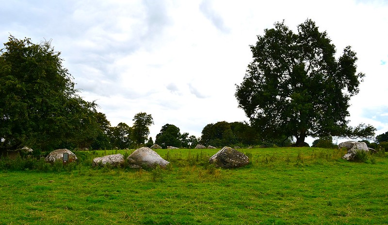
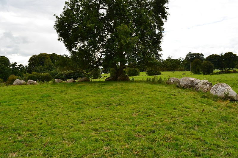
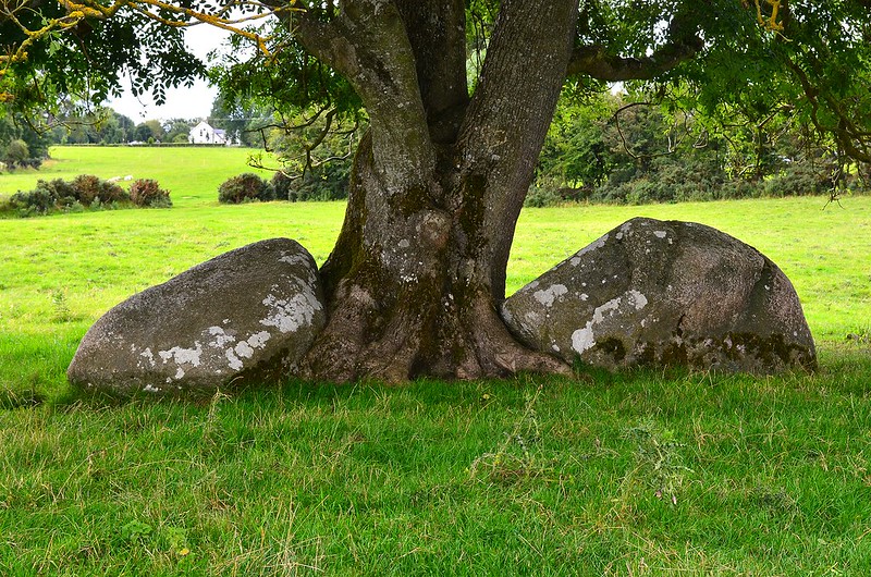
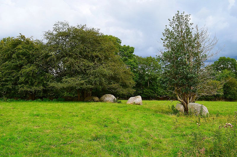
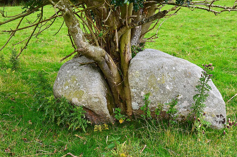
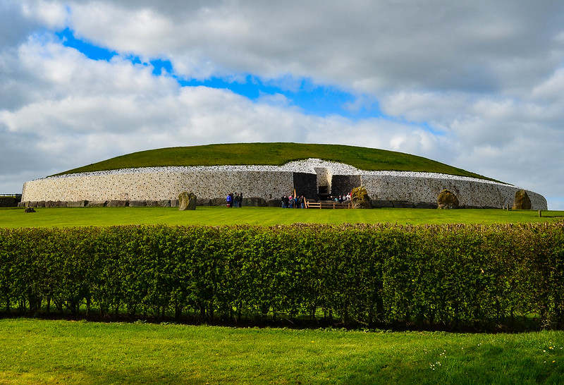
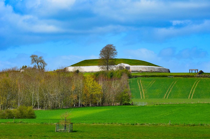
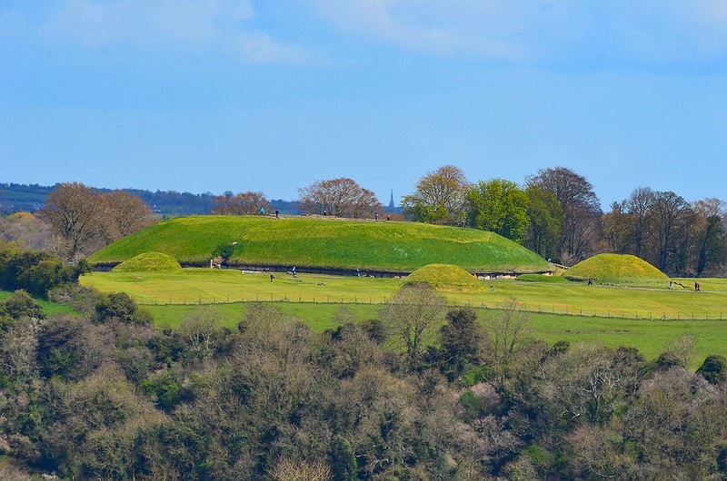
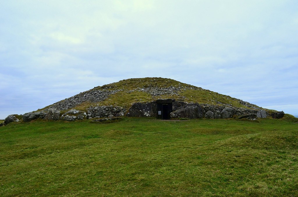
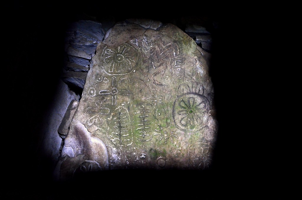
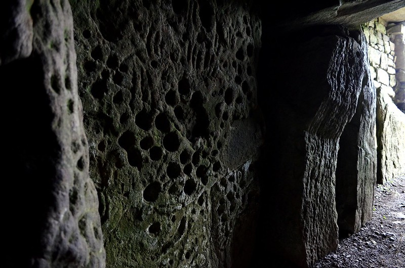
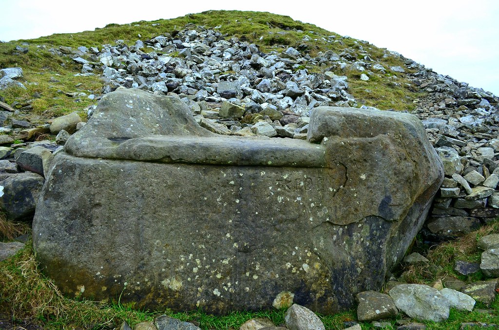
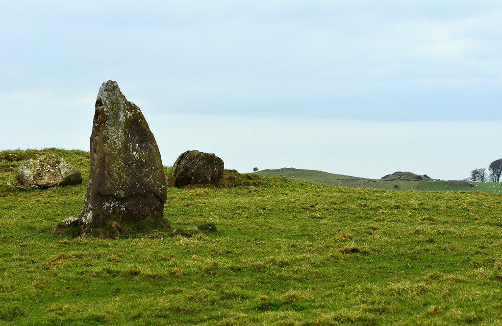
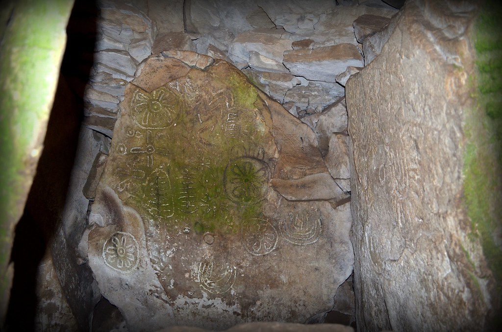
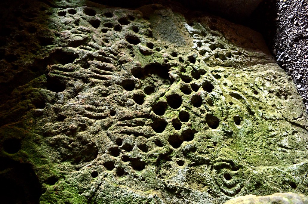
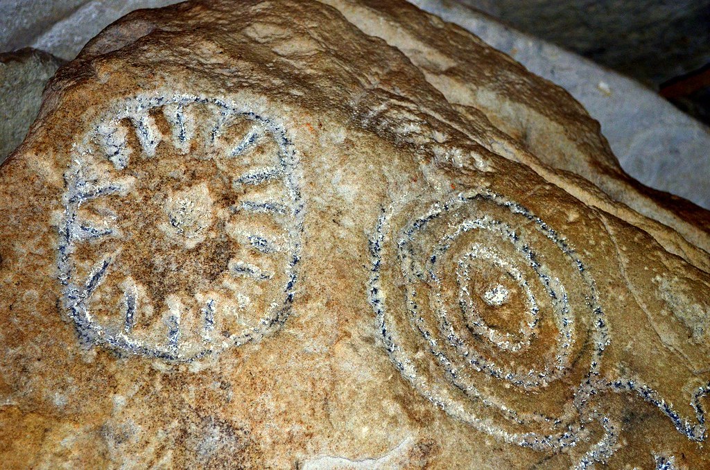
A few Megaliths from last weekend. 800PX PHOTO THREAD!

1235

Comments

  • Registered Users Posts: 6,700 ✭✭✭Mountainsandh


    This is very near me, got drenched walking through fields this morning at sunrise (despite the very dry spell here !).
    PM for location please. :)

    edit : apologies currently re-uploading the pics in case they are not visible

    18776076199_d720909341_z.jpgstanding stone (1 of 1)-37 by Anne L., on Flickr

    18962141535_02056c3c1d_z.jpgstanding stone (1 of 1)-45 by Anne L., on Flickr

    18956791712_557ef0967f_z.jpgstanding stone (1 of 1)-42 by Anne L., on Flickr

    18341534653_4cd6db8195_z.jpgstanding stone (1 of 1)-40 by Anne L., on Flickr

    18956894542_4b91e7e834_z.jpgstanding stone (1 of 1)-38 by Anne L., on Flickr


  • Registered Users Posts: 6,700 ✭✭✭Mountainsandh


    A feature of note are the two quartz veins running parallel, one at the bottom of the stone, the other exposed at the very top. It's well worn now of course, but it must have been pretty striking initially.

    18341488813_61ff415f98_z.jpgstanding stone (1 of 1)-47 by Anne L., on Flickr

    18774429070_e7c95411c4_z.jpgstanding stone (1 of 1)-48 by Anne L., on Flickr

    18776019669_841cdc562c_z.jpgstanding stone (1 of 1)-50 by Anne L., on Flickr


  • Registered Users Posts: 1,327 ✭✭✭bogman


    Happy solstice everybody

    Drombeg Stone Circle this evening after I asked the hippies to vacate the residence


    11206471_10205486701061633_4459344164207082629_o.jpg


  • Registered Users Posts: 1,516 ✭✭✭Maudi


    bogman wrote: »
    Happy solstice everybody

    Drombeg Stone Circle this evening after I asked the hippies to vacate the residence


    11206471_10205486701061633_4459344164207082629_o.jpg

    You too.


  • Closed Accounts Posts: 9,700 ✭✭✭tricky D


    Happy Solstice to you too, bogman!

    Keep up the great work. Love it. Make a book. I'd buy.


  • Advertisement
  • Registered Users Posts: 1,327 ✭✭✭bogman


    Recent trip up the west coast

    Creevykeel Court Tomb
    11415573_10205575519682043_5800340503905459606_o.jpg

    10604682_10205575524562165_1903478222574982954_o.jpg

    11334141_10205575524642167_7376421432873649573_o.jpg


  • Closed Accounts Posts: 608 ✭✭✭Bonedigger


    A few images from my visit to Athgreany, Co.Wicklow, and Broadleas Commons, Co.Kildare. It's been many years since I last saw the stone circles at both these sites which lie less than 5 kilometres from each other.

    'The Piper's Stones', Athgreany stone circle, Co.Wicklow

    20849069780_410d05c1ed_c.jpg

    Of the sixteen granite stones at the site today (John O'Donovan recorded twenty-nine stones in the circle in 1841) only five are in situ, five more are recumbent (but likely to be close to their original positions), three others have been displaced while two smaller stones would not appear to have belonged to the circle originally.

    20908337459_69b7dc3c44_c.jpg

    One of the in situ standing stones with Slievecorragh in the background:

    21033048732_c8f03fdbcd_c.jpg

    One scholar has suggested that the standing stones may have alternated from rectangular to oval in shape around the circle as in the examples below:

    20855195650_f79ae652f2_c.jpg

    21102404991_3a2154fd3e_c.jpg

    A large granite outlier 'the Piper', lies approximately 40 metres to the NE of the circle. According to the 'Archaeological Inventory of County Wicklow' this outlier is a glacial erratic, and unlikely to have been deliberately placed there:

    21099130182_a797e0fcdf_c.jpg

    The top of this outlier has two long, deep grooves running at right angles to each other looking reminiscent of a cross; there are several large cupmarks on the top surface of this stone too. A recumbent stone in the SE part of the circle also bears a curious 'groove', and the grooves on both these stones appear not to be entirely natural.

    One of the grooves on 'the Piper':

    21095387136_98aed2eeb3_c.jpg

    The groove on the recumbent stone in the SE part of the circle:

    20499128124_96f43317f5_c.jpg


    'The Piper's Stones', Broadleas Commons, Co.Kildare

    21095865556_61f6890f39_c.jpg

    This Bronze age stone circle lies less than 5 kilometres north of the stone circle at Athgreany (just off the N81 for Blessington, on the Ballymore Eustace road - R411: http://binged.it/1UwE2hp) and it too is known as 'The Piper's Stones'. It is an almost continuous circle of asymmetrical boulders, the vast majority of which are granite.

    21135006475_e1dca21865_c.jpg

    20905288608_448a690a07_c.jpg

    This stone circle has a certain charm with mature trees growing in between some of the stones, and one granite stone has even been split in two by a Holly:

    21135342345_e604fa44e0_c.jpg

    20932162030_23263e1bed_c.jpg

    20948319149_aa549485e4_c.jpg


  • Moderators, Science, Health & Environment Moderators Posts: 5,218 Mod ✭✭✭✭slowburner


    This groove business is interesting. I was just talking with someone about it the other day. There are similar grooves on the portal tomb at Brennanstown and a few others I can't remember off the top of my head.
    They are man made, without any shadow of doubt but what are they? Why were they made?
    I suspect that they may very well be related to stone cleaving rather than drainage - a prehistoric gutter, if you like. The labour involved in cutting these grooves with prehistoric tools would not repay the effort. It's also doubtful that they would have functioned very well as drainage channels.
    The issue becomes slightly more complex when you see the stone cutters' marks on the stones of Castleruddery. These marks are assumed to be a later attempt to extract stone. While some of the marks do have the appearance of being much later, some are questionably earlier, perhaps much earlier. One large stone may have been partially cleft to make a millwheel. This is clearly later activity, but the others are much more difficult to classify.
    Stonecutter' marks turn up in the strangest places, including Stonehenge, but we know very little about this activity that continued pretty much in the same vein from prehistory to the first half of the 20th century. We don't really know how to date them, based solely on morphology. So many assumptions have been and continue to be made with regard to stonecutter's marks.
    Little bit of a pet subject of mine....


  • Registered Users Posts: 1,454 ✭✭✭bogwalrus


    slowburner wrote: »
    This groove business is interesting. I was just talking with someone about it the other day. There are similar grooves on the portal tomb at Brennanstown and a few others I can't remember off the top of my head.
    They are man made, without any shadow of doubt but what are they? Why were they made?
    I suspect that they may very well be related to stone cleaving rather than drainage - a prehistoric gutter, if you like. The labour involved in cutting these grooves with prehistoric tools would not repay the effort. It's also doubtful that they would have functioned very well as drainage channels.
    The issue becomes slightly more complex when you see the stone cutters' marks on the stones of Castleruddery. These marks are assumed to be a later attempt to extract stone. While some of the marks do have the appearance of being much later, some are questionably earlier, perhaps much earlier. One large stone may have been partially cleft to make a millwheel. This is clearly later activity, but the others are much more difficult to classify.
    Stonecutter' marks turn up in the strangest places, including Stonehenge, but we know very little about this activity that continued pretty much in the same vein from prehistory to the first half of the 20th century. We don't really know how to date them, based solely on morphology. So many assumptions have been and continue to be made with regard to stonecutter's marks.
    Little bit of a pet subject of mine....

    may be for transport reasons. better grip or similar?


  • Moderators, Science, Health & Environment Moderators Posts: 5,218 Mod ✭✭✭✭slowburner


    bogwalrus wrote: »
    may be for transport reasons. better grip or similar?
    Interesting thought.


  • Advertisement
  • Registered Users Posts: 17,862 ✭✭✭✭Thargor


    Thanks Mountainsandh, I'm glad someone likes them!

    I'm glad you bumped the thread as well, I keep forgetting to throw some pics into it,

    A couple more from Loughcrew, hopefully I didn't put these up already.

    193468.jpg

    193469.jpg

    193470.jpg

    193471.jpg

    193472.jpg
    Wow missed this post from 2012 first time around, stunning! I am heading there ASAP.


  • Registered Users Posts: 17,862 ✭✭✭✭Thargor


    bogman wrote: »
    Doorus wedge tomb near Kinvarra County Galway, weather has been kind recently :D


    53.09.09.2 N
    08.58.21.4 W

    482476_10200256241463412_1880404312_n.jpg

    315918_10200256243823471_1914123424_n.jpg

    480902_10200256242263432_1898725153_n.jpg

    936968_10200256245183505_1698047239_n.jpg
    Hi Bogman, Im trying to map this as I pass through the area a lot but I keep getting those coordinates to show in the sea east of London, are the coordinates right? Google has plenty of images of the tomb but no proper directions to it.

    Also all your images in this thread except the last couple are dead so a big loss there, Imgur is really the only image host you can trust long term.

    EDIT: Nevermind, on the phone Google Maps shows them there, on the laptop it shows up fine, Ive cycled past there on my bike and never knew it was in over the wall...


  • Registered Users Posts: 3,567 ✭✭✭cfuserkildare


    Loughcrewe is an AWESOME site, over 38 registered passage tombs, and literally you cannot look in any direction from the top, you see an earthwork or ringfort.
    Probably the best site I have ever visited.
    Would take decades to properly map and catalogue the whole area. Could be as much as 20x30 kms in size.
    Amazing.


  • Closed Accounts Posts: 608 ✭✭✭Bonedigger


    Kilgowan standing stone, Co.Kildare

    I've passed by this standing stone more times than I can remember on my way down the R448 to Castledermot, and until now, had never stopped to take a closer look. At first glance it looks like the standing stone is sitting on top of a large man-made mound, but the "mound" is in fact the northerly end of a quarried away esker. This is more or less what you see from the side of the road:

    21626943626_e88e135427_c.jpg

    Approaching the standing stone, I could see what looked like an engraving on its SW face, and got a little excited thinking it ancient rock art, but no, it was a rather weathered looking cross:

    21037969223_65e90f5421_c.jpg

    The stone itself is granite and stands 2.3 metres tall. If not an erratic, it may have been deliberately brought from the Wicklow mountains which lie not far to the east. The view from this low mound is panoramic and very beautiful, and it's not difficult to understand why the prehistoric peoples placed the stone there originally. In the image below one can see the Wicklow mountains on the horizon to the east; the mountain left of the standing stone is Lugnaquilla, Leinster's highest peak, and the mountain to the right is Keadeen:

    21466307439_ca588a7d76_c.jpg

    Brewel hill lies 2.5 kilometres south of Kilgowan standing stone (see below). The conifer trees at its summit surround a prehistoric stone circle, and both the stone circle and trees are surrounded by a circular enclosure which is believed to be a henge monument. A possible cursus monument was discovered on the opposite side of this hill in recent years.

    21465778950_8b100d2c27_c.jpg

    Incidentally, it is believed that one of two priests, a Fr.Lawlor or Fr.Cummins, who both lived close to Kilgowan crossroads in the 19th Century, may have been responsible for the engraving of the cross on the standing stone.


  • Registered Users Posts: 11,191 ✭✭✭✭Nekarsulm


    Don't know if I posted this before or not. Its on my land about 600 yards from where Cavan, Leitrim and Longford meet up. About 5'6" at the highest point.


  • Registered Users Posts: 11,191 ✭✭✭✭Nekarsulm


  • Registered Users Posts: 419 ✭✭bawn79


    Nekarsulm wrote: »
    Don't know if I posted this before or not. Its on my land about 600 yards from where Cavan, Leitrim and Longford meet up. About 5'6" at the highest point.

    Do you know if it has been reported to the National Monuments Service? Ie is it a recorded monument?


  • Registered Users Posts: 419 ✭✭bawn79


    Nekarsulm wrote: »

    That is interesting - I just checked the Records of Monument & Places (RMP) and that stone circle at Eskine isn't noted. I wonder is it a modern built one?
    On the link to google maps you can clearly see the circle, its very close to one of the cottages so I'd be leaning towards it being a modern one.
    I would be cool to have a circle on your land though!


  • Registered Users Posts: 11,191 ✭✭✭✭Nekarsulm


    bawn79 wrote: »
    Do you know if it has been reported to the National Monuments Service? Ie is it a recorded monument?

    Bawn, I don't know. There was another larger slab of stone resting across this one at one time, according to my uncle, but it was broken up for stone in the 1930's.
    When the REPS environmental scheme was running, it was a noted feature and had to be completely fenced off to prevent cattle running on it. But that was the Dept. Ag.


  • Registered Users Posts: 419 ✭✭bawn79


    Nekarsulm wrote: »
    Bawn, I don't know. There was another larger slab of stone resting across this one at one time, according to my uncle, but it was broken up for stone in the 1930's.
    When the REPS environmental scheme was running, it was a noted feature and had to be completely fenced off to prevent cattle running on it. But that was the Dept. Ag.

    If you want to PM me where it is on bing maps (or similar) I can check the record for you.
    Alternatively http://www.archaeology.ie/archaeological-survey-ireland - this will do the same thing if you can navigate your way around it.


  • Advertisement
  • Registered Users Posts: 11,191 ✭✭✭✭Nekarsulm


    I can find it on Bing maps, but on the phone so will try later to get a lat and long reading for you. My cousin has a farm nearby with the best ring fort I have yet seem. Twenty foot deep moat in places, bank eight foot high when you're inside, as usual bank is planted with hazel etc, and an ancient whitethorn in the dead centre.


  • Registered Users Posts: 11,191 ✭✭✭✭Nekarsulm


    The stone is at Lat. 53.947718
    Long. -7.602153


  • Registered Users Posts: 419 ✭✭bawn79


    Nekarsulm wrote: »
    The stone is at Lat. 53.947718
    Long. -7.602153

    Just checked there - there is nothing on the National Monuments Schedule in that townland so it probably hasn't been noted before.

    There is a form you can download and fill in here to report it to the national monuments http://www.archaeology.ie/archaeological-survey-ireland PM me if you need any help with it.


  • Closed Accounts Posts: 506 ✭✭✭Hotei


    26636831546_6d0cbcfbbe_c.jpg

    26664439975_c6a6bf9afa_c.jpg

    26401595020_78a04b23eb_c.jpg

    26634739401_0d2512a8ef_c.jpg


  • Registered Users Posts: 1,327 ✭✭✭bogman


    Happy winter Solstice from Drombeg Stone Circle everybody

    15578420_10209655685763645_3121890396151677107_n.jpg?oh=2ece2ccfc60e850f966550d849184132&oe=58EB725E

    15589515_10209655687603691_7726103170497600662_n.jpg?oh=1518a38a5390e73abc189d31af016de4&oe=58DB07A1

    15540914_10209655687883698_4826081858747714111_o.jpg?oh=1c3da02d245bc0e0d53957968b5e94ea&oe=58DD5BA0

    15697705_10209655688683718_3232435949602041683_n.jpg?oh=8c0fdf15722e4df42a19f216ae38691b&oe=58ECB5BA


  • Closed Accounts Posts: 506 ✭✭✭Hotei


    Cairn T, Carnbane East:

    30598929214_5c0af7d8ef_b.jpg


    Cairn T 'Equinox stone':

    31421203235_837dc82c1b_b.jpg

    32144622925_4d9d58506d_c.jpg

    31333020173_5a904346ae_b.jpg

    30683335743_c2ced5079f_c.jpg


    The Hag's Chair:

    32025744261_fd4575ebe4_b.jpg


    Cairn L can be seen in the distance sitting close to the summit of Carnbane West:

    31445921755_de555f780c_b.jpg


  • Registered Users Posts: 5,962 ✭✭✭GhostInTheRuins


    I'm glad to see some action in this thread again. Keep it up lads! I'll try to get out and about myself sometime.


  • Closed Accounts Posts: 506 ✭✭✭Hotei


    The west recess:

    31376018444_524057984a_b.jpg


    Passage orthostat rock art:

    32068533452_829e8c3b69_b.jpg

    32098504111_0df3ee816f_b.jpg


    Rock art on the roof slab in the west recess:
    Members of the public often use chalk and crayons to outline the engravings which can cause unnecessary wear to the rock art.

    32346200496_abef23b13d_b.jpg


    Rock art in the north recess:

    32234968322_6d318965e7_b.jpg

    31574047183_f70af280f0_b.jpg


    An engraving on the rear stone in the west recess:

    32144550695_ce1066c565_b.jpg


  • Registered Users Posts: 3,567 ✭✭✭cfuserkildare


    Have always been fascinated with LoughCrewe,
    Possibly because so little is known about it.
    The whole area is pock marked with items of ancient occupation.


  • Advertisement
  • Registered Users Posts: 15 ivar the boneless


    Hmmmmm
    A general lack of weathering ,surface differences all round and the clean breaks ,sharp edging suggest non antiquity.
    The early edition map makers were very generally accurate.
    What does local folklore say??
    Might these be quarried and brought in some time in the past
    the edges are catching my eye too recent / sharp etc


Advertisement