Advertisement
If you have a new account but are having problems posting or verifying your account, please email us on hello@boards.ie for help. Thanks :)
Hello all! Please ensure that you are posting a new thread or question in the appropriate forum. The Feedback forum is overwhelmed with questions that are having to be moved elsewhere. If you need help to verify your account contact hello@boards.ie

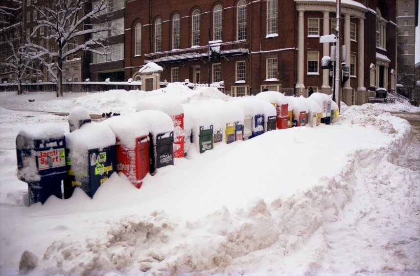
Major Snow/Rain Storm to hit Boston.

  • 28-10-2011 6:42pm
    #1
    Registered Users Posts: 273 ✭✭


    400x266_10281424_nestorm.jpgmap1.jpg?w=300&h=266

    October 28, 2011BOSTON, MA.A major nor’easter is about to pound southern New England with heavy rain, snow and wind. In more than 100 years of record keeping in Boston the most snow the city has ever seen in the month of October is 1.1 inches, six years ago on October 29, 2005. This storm is almost certain to be one for the record books in all of southern New England. The precipitation will begin Saturday afternoon between 3 and 5 p.m., as mainly rain for all of eastern Massachusetts, a mix in higher elevations to the west. The intensity of the precipitation will increase rapidly over the next several hours and the rain-snow line will collapse to the south and east as colder air is drawn into the deepening storm on shifting winds to the north. By midnight, it will be snowing just about everywhere with the exception of southeastern Mass. where it will continue to rain very heavily. The rain-snow line will collapse further southeast to around the Cape Cod Canal in the pre-dawn hours of Sunday morning before the storm system pulls away and the precipitation shuts off just after dawn. This storm will be so intense it should be able to overcome these typical October atmospheric issues and draw down very cold air from aloft. The highest snow totals will be in the higher elevated areas including Worcester County, southwestern New Hampshire, the Berkshires and many of the mountains of central and northern New England. These areas, above 1,000 feet in elevation could easily see 6-to-10 inches of snowfall from this event. Areas closer to Interstate 495 would likely fall in the 3-to-6 inch range and closer to the coast including the city of Boston 1-to-3 inches. These totals could shift based upon the timing of the rain-snow change, if it occurs faster in eastern Massachusetts the totals could go higher. -CBS


«1

Comments

  • Registered Users Posts: 251 ✭✭dbyrne


    why cant we get reports like this? Wouldnt it be lovely to see a map of ireland with dublin highlighted with 12 inches of snow forcast.... Lamp watching would take on a whole new meaning :D


  • Registered Users Posts: 610 ✭✭✭muckish


    Was there a few years back for one of these Nor'easters. Amazing experience. Nearly 30" snow overnight in downtown Boston.
    4359565006_b2f2bcb81e_o.jpg


  • Moderators, Home & Garden Moderators, Science, Health & Environment Moderators Posts: 17,681 Mod ✭✭✭✭DOCARCH


    Ah crap! I'm flying to Boston on Monday! Love snow but love holidays more!!!


  • Registered Users Posts: 5,491 ✭✭✭bb1234567


    DOCARCH wrote: »
    Ah crap! I'm flying to Boston on Monday! Love snow but love holidays more!!!
    friend of mine is flying to Boston this weekend too!


  • Moderators, Home & Garden Moderators, Science, Health & Environment Moderators Posts: 17,681 Mod ✭✭✭✭DOCARCH


    I see 1" forecast for Boston. Hopefully it will have melted by Monday - looks as if it should.


  • Advertisement
  • Registered Users Posts: 273 ✭✭Weylin


    muckish wrote: »
    Was there a few years back for one of these Nor'easters. Amazing experience. Nearly 30" snow overnight in downtown Boston.
    4359565006_b2f2bcb81e_o.jpg
    WOW!!! dont think winter tyres would work there.....


  • Registered Users Posts: 7,276 ✭✭✭kenmc


    Those Lucky, Lucky Ba$tards.


  • Registered Users Posts: 11,134 ✭✭✭✭maquiladora


    URGENT - WINTER WEATHER MESSAGE
    NATIONAL WEATHER SERVICE GRAY ME
    524 AM EDT SAT OCT 29 2011

    ...POTENTIALLY DAMAGING AND HISTORIC OCTOBER SNOWSTORM LIKELY FOR
    TONIGHT INTO SUNDAY...


    .LOW PRESSURE WILL RAPIDLY INTENSIFY AS IT MOVES UP THE MID
    ATLANTIC COAST TODAY. THE LOW WILL PASS BY CAPE COD TONIGHT WHILE
    STRENGTHENING RAPIDLY AND MOVING NORTHEAST.

    PRECIPITATION SHOULD QUICKLY OVERSPREAD THE REGION FROM SOUTH TO
    NORTH STARTING IN THE AFTERNOON HOURS ACROSS SOUTHERN NH AND
    SOUTHERNMOST MAINE. THE LEADING EDGE OF THE SNOW SHIELD WILL
    QUICKLY ADVANCE NORTHWARD DURING THE EVENING HOURS. TEMPERATURES
    NEAR THE GROUND ON THE COASTAL PLAIN WILL PROBABLY BE WARM ENOUGH
    FOR THE PRECIPITATION TO START AS RAIN OR A RAIN SNOW MIX...BUT
    ONCE HEAVIER PRECIPITATION STARTS FALLING...ANY RAIN SHOULD FLIP
    OVER TO HEAVY WET SNOW. THE CHANGE TO SNOW WILL PROBABLY BE
    DELAYED A BIT LONGER ALONG THE IMMEDIATE COAST GIVEN THE
    RELATIVELY WARM WATER TEMPERATURES THIS TIME OF YEAR.

    THE EXPECTED HEAVY AND WET NATURE OF THE SNOW WILL STICK TO TREES
    AND LIKELY CAUSE BRANCHES TO BREAK...ESPECIALLY ON TREES THAT
    STILL HAVE LEAVES. EVEN JUST A FEW INCHES OF WET SNOW CAN CAUSE
    SMALLER BRANCHES TO START BREAKING. EVENTUALLY...WITH ENOUGH SNOW
    AND SOME WIND...ENTIRE TREES COULD SNAP. THIS WILL CREATE A
    SITUATION WHERE THE POTENTIAL EXISTS FOR WIDESPREAD POWER
    OUTAGES. RESIDENTS SHOULD PREPARE THEMSELVES FOR THE POSSIBILITY
    OF EXTENDED POWER OUTAGES. ROADS WILL ALSO BECOME SNOW COVERED
    AND TREACHEROUS.

    THE STORM WILL MOVE OUT SUNDAY MORNING...BUT IT WILL REMAIN COLD
    AND WINDY IN THE WAKE OF THE SYSTEM.

    MEZ007>009-012>014-019>022-NHZ001>004-291730-
    /O.CON.KGYX.WS.W.0012.111030T0000Z-111030T1800Z/
    NORTHERN OXFORD-NORTHERN FRANKLIN-CENTRAL SOMERSET-
    SOUTHERN OXFORD-SOUTHERN FRANKLIN-SOUTHERN SOMERSET-
    INTERIOR CUMBERLAND-ANDROSCOGGIN-KENNEBEC-INTERIOR WALDO-
    NORTHERN COOS-SOUTHERN COOS-NORTHERN GRAFTON-NORTHERN CARROLL-
    INCLUDING THE CITIES OF...ANDOVER...ROXBURY...UPTON...
    WILSONS MILLS...COBURN GORE...RANGELEY...KINGFIELD...BINGHAM...
    JACKMAN...RUMFORD...NORWAY...FRYEBURG...OXFORD...FARMINGTON...
    WILTON...MADISON...SKOWHEGAN...PITTSFIELD...NORTH WINDHAM...
    GORHAM...BRIDGTON...LEWISTON-AUBURN...LIVERMORE FALLS...AUGUSTA...
    WATERVILLE...WINTERPORT...UNITY...COLEBROOK...BERLIN...
    LANCASTER...LITTLETON...NORTH CONWAY
    524 AM EDT SAT OCT 29 2011

    ...WINTER STORM WARNING REMAINS IN EFFECT FROM 8 PM THIS EVENING
    TO 2 PM EDT SUNDAY...

    * LOCATIONS...CENTRAL AND NORTHERN NEW HAMPSHIRE AS WELL AS
    INTERIOR SOUTHERN AND CENTRAL MAINE...INCLUDING THE WESTERN
    MAINE MOUNTAINS.

    * HAZARD TYPES...HEAVY WET SNOW.

    * ACCUMULATIONS...6 TO 12 INCHES OF SNOW.

    * TIMING...RAIN OR A RAIN SNOW MIX SHOULD BEGIN TO OVERSPREAD THE
    WARNING AREA BY VERY LATE AFTERNOON OR EARLY EVENING. ANY RAIN
    SHOULD FLIP OVER TO HEAVY WET SNOW BY DURING THE EVENING HOURS.
    THE PRECIPITATION SHOULD START AS ALL SNOW IN THE HIGHER
    ELEVATIONS. THE HEAVIEST SNOWFALL IS EXPECTED TO FALL OVERNIGHT
    INTO EARLY SUNDAY MORNING. THE SNOW WILL TAPER OFF AND END FROM
    SOUTH TO NORTH SUNDAY MORNING OR VERY EARLY AFTERNOON.

    * IMPACTS...TREE DAMAGE AND POWER OUTAGES FROM HEAVY WET SNOW
    AND WIND. ROADS WILL BECOME SNOW COVERED OVERNIGHT.

    * WINDS...NORTH 15 TO 25 MPH WITH GUSTS UP TO 35 MPH.

    * TEMPERATURES...AROUND 30.

    * VISIBILITIES...ONE QUARTER MILE OR LESS AT TIMES.

    PRECAUTIONARY/PREPAREDNESS ACTIONS...

    A WINTER STORM WARNING FOR HEAVY SNOW MEANS SEVERE WINTER WEATHER
    CONDITIONS ARE EXPECTED OR OCCURRING. SIGNIFICANT AMOUNTS OF
    SNOW ARE FORECAST THAT WILL MAKE TRAVEL DANGEROUS. ONLY TRAVEL IN
    AN EMERGENCY. IF YOU MUST TRAVEL...KEEP AN EXTRA FLASHLIGHT...
    FOOD...AND WATER IN YOUR VEHICLE IN CASE OF AN EMERGENCY.

    I sense there will be some Snow-envy on here. :P


  • Closed Accounts Posts: 2,693 ✭✭✭Redsunset


    URGENT - WINTER WEATHER MESSAGE
    NATIONAL WEATHER SERVICE NEW YORK NY
    1027 AM EDT SAT OCT 29 2011

    ...A HISTORIC EARLY SEASON SNOWSTORM FOR INTERIOR SECTIONS OF THE
    LOWER HUDSON VALLEY...SOUTHERN CONNECTICUT AND NORTHEAST NEW
    JERSEY...

    NJZ002-NYZ067-068-292230-
    /O.CON.KOKX.WS.W.0008.000000T0000Z-111030T0600Z/
    WESTERN PASSAIC-ORANGE-PUTNAM-
    1027 AM EDT SAT OCT 29 2011

    ...WINTER STORM WARNING REMAINS IN EFFECT UNTIL 2 AM EDT SUNDAY...

    * LOCATIONS...WESTERN PASSAIC...ORANGE AND PUTNAM COUNTIES.

    * HAZARD TYPES...HEAVY WET SNOW AND BRISK WINDS.

    * ACCUMULATIONS...10 TO 14 INCHES OF SNOW.

    * WINDS...NORTH 10 TO 20 MPH WITH GUSTS UP TO 35 MPH.

    * TEMPERATURES...IN THE MID 30S.

    * VISIBILITIES...ONE QUARTER MILE OR LESS AT TIMES.

    * TIMING...PRECIPITATION WILL OVERSPREAD THE AREA FROM THE SOUTH
    THROUGH NOON. A MIX OF RAIN AND SNOW WILL QUICKLY CHANGE TO ALL
    SNOW AS THE INTENSITY OF THE PRECIPITATION INCREASES. SNOW WILL
    BECOME HEAVY AT TIMES THIS AFTERNOON...AND TAPER OFF FROM WEST
    TO EAST LATE TONIGHT.

    * IMPACTS...WIDESPREAD HAZARDOUS TRAVEL CONDITIONS DUE TO SNOW
    COVERED ROADS AND REDUCED VISIBILITIES. STRONG WINDS AND HEAVY
    WET SNOW WILL RESULT IN DOWNED TREES...TREE LIMBS AND POWER
    LINES. THE DAMAGE COULD BE QUITE EXTENSIVE WITH THE POTENTIAL
    FOR AN AREA OF WIDESPREAD POWER OUTAGES.

    PRECAUTIONARY/PREPAREDNESS ACTIONS...

    A WINTER STORM WARNING MEANS SIGNIFICANT AMOUNTS OF SNOW AND
    STRONG WINDS ARE EXPECTED. THIS WILL MAKE TRAVEL VERY HAZARDOUS
    OR IMPOSSIBLE. ONLY TRAVEL IN AN EMERGENCY. IF YOU MUST TRAVEL...
    KEEP AN EXTRA FLASHLIGHT...FOOD...AND WATER IN YOUR VEHICLE IN
    CASE OF AN EMERGENCY.


  • Registered Users Posts: 1,021 ✭✭✭Sulmac


    Excellent coverage as always available on the Weather Channel (live stream).


  • Advertisement
  • Registered Users Posts: 5,068 ✭✭✭Iancar29


    Gonna try contact my uncle through facetime soon to see some snow!! WOOOOOOO!!!! :D haha :)


  • Closed Accounts Posts: 4,279 ✭✭✭Su Campu


    Snowing now from Washington D.C. to Massachussets, including NYC. Only 0.6 °C at Kennedy and Newark.

    201110291800_e2_40N075W_Sg.gif


  • Registered Users Posts: 5,491 ✭✭✭bb1234567


    uncle in ny city says its snowing there lightly for last 2 hours and says its very cold:)


  • Registered Users Posts: 1,003 ✭✭✭Lucreto


    Pity it is the wet snow and not the good old dry stuff but snow is snow.

    I just hope we get something soon.

    But a few good picture will do for now.


  • Registered Users Posts: 7,276 ✭✭✭kenmc


    s'not fair. They get good snow every year, now they're getting it early as well. Jammy gits. Grrrrrrrrrrr


  • Closed Accounts Posts: 11,909 ✭✭✭✭Wertz


    They're welcome to it... that much snow this early in teh season and powercuts to boot? F*ck that. Some of those folk are still getting over the effects of Irene...


  • Registered Users Posts: 9,573 ✭✭✭lord lucan


    Just seen this pic on Facebook from a friend in Yonkers,NY.

    377465_10150345433134013_674464012_8317150_97815764_n.jpg


  • Registered Users Posts: 1,204 ✭✭✭eskimocat


    Wow, it looks amazing there. Its so early in the year too!Hope they had time to prepare.. Still how can you prepare for a historic fall of Snow :o


  • Registered Users Posts: 5,068 ✭✭✭Iancar29


  • Closed Accounts Posts: 2,876 ✭✭✭Spread


    Two inches on Thursday night and 12" to 16" forecast here over the next 12 hours. Started about 3PM (local) and already about 2". Wind up to 40 MPH by 7PM so white-out conditions. But Monday and Tuesday are in the upper 40s*F, so this will be toast by midweek. Have to drive 6 miles for game of Whist this evening ........ so will bring extra vino and our jammies :D


  • Advertisement
  • Closed Accounts Posts: 454 ✭✭irishdub14


    Snowing in times square, there's tears in my eyes with excitement and envy...!!

    http://www.earthcam.com/usa/newyork/timessquare/


  • Closed Accounts Posts: 454 ✭✭irishdub14


    Iancar29 wrote: »

    Sorry, didn't see this! lol :D


  • Registered Users Posts: 117 ✭✭srocliffe


    And I'm not seeing the snow, just looks like rain to me.


  • Closed Accounts Posts: 454 ✭✭irishdub14


    srocliffe wrote: »
    And I'm not seeing the snow, just looks like rain to me.

    click on 'Cam 3 - North View'


  • Registered Users Posts: 117 ✭✭srocliffe


    They need wipers on that cam :-) then I might see the snow.


  • Registered Users Posts: 14,316 ✭✭✭✭M.T. Cranium


    Snow heaviest about 20-50 miles inland from northeast PA through northern NJ into western CT and MA, later into southern VT and NH, some amounts of 25-40 cms reported from this zone. The coastal cities may have seen some snow earlier but will stay with a sleety mix until the storm pulls away on Sunday.

    Quite unusual to see a measurable snowfall this close to the northeast "megalopolis" in October, for example, Newark NJ had a daily record of trace set on several occasions in a long period, but saw 3 inches already today. Same general idea for Central Park NYC.

    Probably means very little to winter forecast as the pattern could change by December, but will set monthly records in many places since the existing records are so tiny. To place this in some perspective, Toronto with 170 years of records has only seen two October snowfalls larger than Newark has seen today, and one of those was on the last day of the month in 1844 -- so in the 20th century and early 21st century, just one day with more snow than this warmer location is seeing today. (That was Oct 22, 1969 when about 15 cms fell).

    Lake effect snowfalls can be heavy in October, but nor'easter or synoptic scale snowfall in general very unusual, tends to start up in most years around mid-November at the earliest. What's also very unusual is for these large cities to be challenging daily record minimum temperatures that are often from a long time ago when urban heat islands were smaller, and in the daytime hours rather than overnight when daily minimum records are almost always set.


  • Closed Accounts Posts: 2,876 ✭✭✭Spread


    Updated Oct 29, 2011, 4:50pm EDT


    Weather in Motion® | Enlarge Map
    Get WeatherReady

    ·WeatherReady Safety Tips
    ·More Severe Weather Readiness Tips
    ·National and Local Weather News
    ·Watches & Warnings Explained
    ·Storm Watch (video)


    Southern New Hampshire

    ... TRAVEL IS NOT RECOMMENDED TONIGHT ACROSS SOUTHERN NEW HAMPSHIRE TONIGHT...
    MODERATE TO HEAVY WET SNOW WILL CONTINUE TO FALL ACROSS THE REGION THROUGH THE EVENING HOURS. THE SNOW WILL FALL AT RATES OF 1 TO 2 INCHES PER HOUR AT TIMES... REDUCING VISIBILITIES TO ONE QUARTER OF A MILE. UNTREATED ROADS ARE BECOMING SNOW COVERED AND SLIPPERY. IN ADDITION... THE WET SNOW WILL BEGIN TO RESULT IN DOWNED TREES AND POWER OUTAGES. SOME ROADWAYS WILL LIKELY BECOME BLOCKED BY FALLING TREES TONIGHT AND TRAVEL IS NOT RECOMMENDED.

    About 5" in just under three hours. This is pre-storm as wind is due to whip up.


  • Registered Users Posts: 3,033 ✭✭✭redsteveireland


    A friend of mine in phili, said the snow is crazy over there! Jealous much?


  • Registered Users Posts: 5,068 ✭✭✭Iancar29


    Heavy wet snow = Broken branches...

    Well Jealous right now!!! :(:(:(


    Not of the Church aspect though! ha :rolleyes:


  • Advertisement
  • Registered Users Posts: 31,813 ✭✭✭✭Mars Bar


    That's mad. Imagine not being able to go trick 'r Treating coz of the snow?! :D


Advertisement