Advertisement
If you have a new account but are having problems posting or verifying your account, please email us on hello@boards.ie for help. Thanks :)
Hello all! Please ensure that you are posting a new thread or question in the appropriate forum. The Feedback forum is overwhelmed with questions that are having to be moved elsewhere. If you need help to verify your account contact hello@boards.ie
Hi all,
Vanilla are planning an update to the site on April 24th (next Wednesday). It is a major PHP8 update which is expected to boost performance across the site. The site will be down from 7pm and it is expected to take about an hour to complete. We appreciate your patience during the update.
Thanks all.

The development of Towns and Cities from old maps and aerial photos

  • 13-06-2012 8:08am
    #1
    Moderators, Social & Fun Moderators Posts: 12,555 Mod ✭✭✭✭


    I'm fascinated with the way that towns and cities develop over time and I've built up a small collection of old aerial photos and many old street maps to chart the evolution of the built environment and the patterns of growth that our cities and towns have experienced.

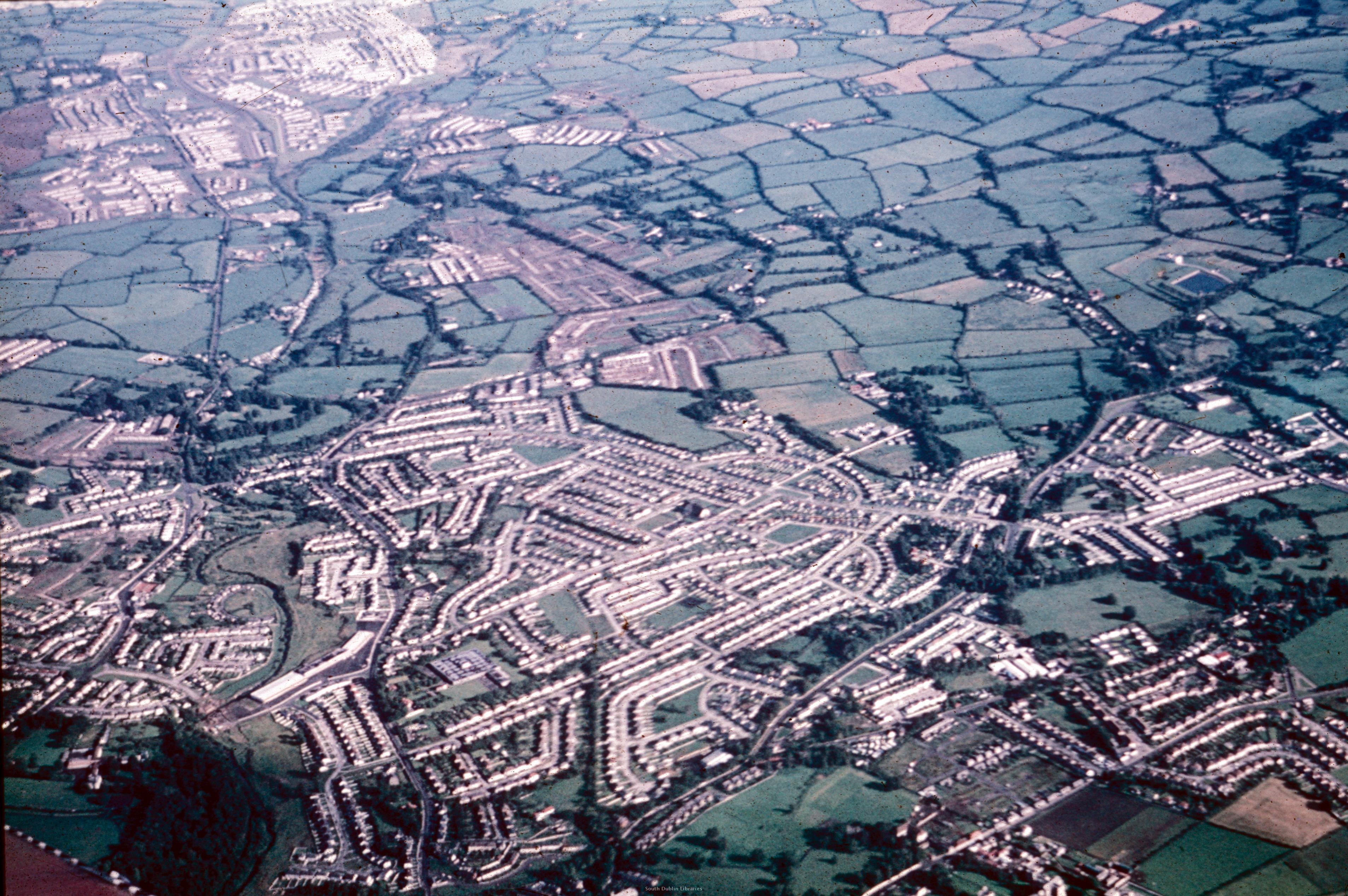
    Here's one interesting image. It was taken in September 1972 and shows the Templeogue, Knocklyon and Ballyboden areas with |Tallaght in the distance. You can clearly see that already the first parts of Tallaght have been developed and housing development just starting in Knocklyon by developers such as McInerney.

    Note that the image is reversed - to get a proper perspective you need to flip it horizontally. *Mods - feel free to reduce the size of the image and flip it if you can.

    wm_1100.jpg


Comments

  • Registered Users Posts: 78,234 ✭✭✭✭Victor


    Reversed. Re-sized. Annotated.


  • Registered Users Posts: 2,081 ✭✭✭GetWithIt


    The OSI site, whether by accident or design, actually does a really good job of allowing you to track the development of areas over time.

    Here is the same area as the photo. In the dialog on the bottom right you can switch between images from 95, 00, 05 and present day. There is even historical data from the 1800's.


  • Registered Users Posts: 3,284 ✭✭✭dubhthach


    It's a pity that OSi doesn't have older aerial photos I've seen snippets of aerial photos taken from Air Corps during the 1960's (or earlier) of urban areas. A publicly accesible archive on the Internet would be great, awh well.


  • Registered Users Posts: 4,905 ✭✭✭Aard


    The OSi is great. On their map viewer, there's a function where you can overlay different maps/photos with vaying degrees of transparency. It also has all the old townland(?) boundaries, which is especially interesting for Dublin as a lot of the names have gone out of use.


  • Registered Users Posts: 3,284 ✭✭✭dubhthach


    Aard wrote: »
    The OSi is great. On their map viewer, there's a function where you can overlay different maps/photos with vaying degrees of transparency. It also has all the old townland(?) boundaries, which is especially interesting for Dublin as a lot of the names have gone out of use.

    Those townland boundaries are still valid. The one I find most fun with is the boundary between Sandymount and Irishtown. Technically Sandymount Catholic church is actually in Irishtown (townland). You often see houses around it advertising themselves as Sandymount let they all technically in Irishtown! :D


  • Advertisement
  • Registered Users Posts: 14,761 ✭✭✭✭Winters


    The development of Towns and Cities from old maps and aerial photos

    Development? More like destruction!

    Yeah the OSI map is brilliant, you can really notice the sprawl and lost opportunities at creating proper towns.

    Sadly there is still nothing to stop developers and marketing people from naming their developments whatever they want.

    The appallingly located and designed Waterside and Holywell developments beside the M1 in Swords have often been called Malahide. Ridiculous.


  • Moderators, Social & Fun Moderators Posts: 12,555 Mod ✭✭✭✭JupiterKid


    Blanchardstown in June 1973.

    Work is just starting on Corduff with the main roads for this area being excavated. Most of the area between Blanchardstown village and Coolmine has already been developed for housing - Coolmine, Glenville and Roselawn. Delwood is just outside of the image coverage.

    Coolmine Community school, to the LHS of the image, has just been built.

    71392149_osi_blanch_aerial_image_june_1973_02.jpg


  • Registered Users Posts: 885 ✭✭✭alentejo


    Great Photo of Rathfarnham.


  • Registered Users Posts: 18 DomhnallOg


    Well done Jupiterkid - fascinating


  • Moderators, Social & Fun Moderators Posts: 12,555 Mod ✭✭✭✭JupiterKid


    The new Dublin suburb of Drimnagh in the 1940s

    attachment.php?attachmentid=1068&stc=1&d=1214748376


  • Advertisement
  • Moderators, Social & Fun Moderators Posts: 12,555 Mod ✭✭✭✭JupiterKid


    Aerial View of Rathfarnham, Templeogue, Knocklyon and Tallaght (in the distance), September 1972 - re-sized, and annotated. With thanks to Victor.

    208720.JPG


  • Moderators, Social & Fun Moderators Posts: 12,555 Mod ✭✭✭✭JupiterKid


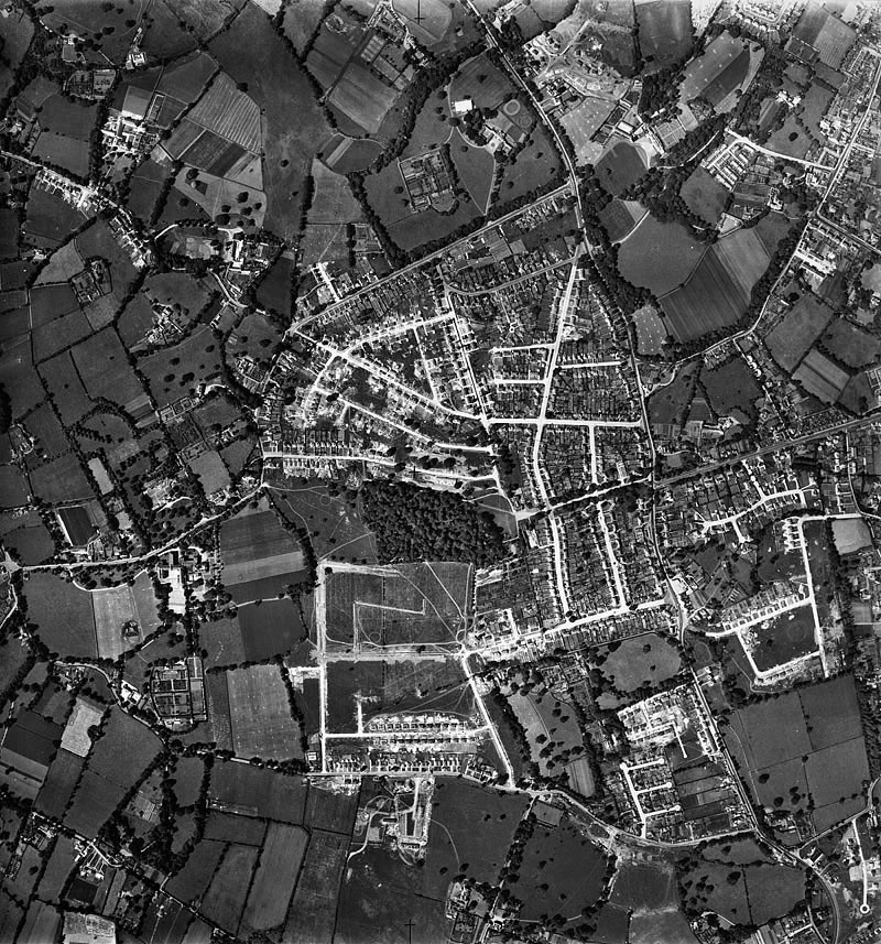
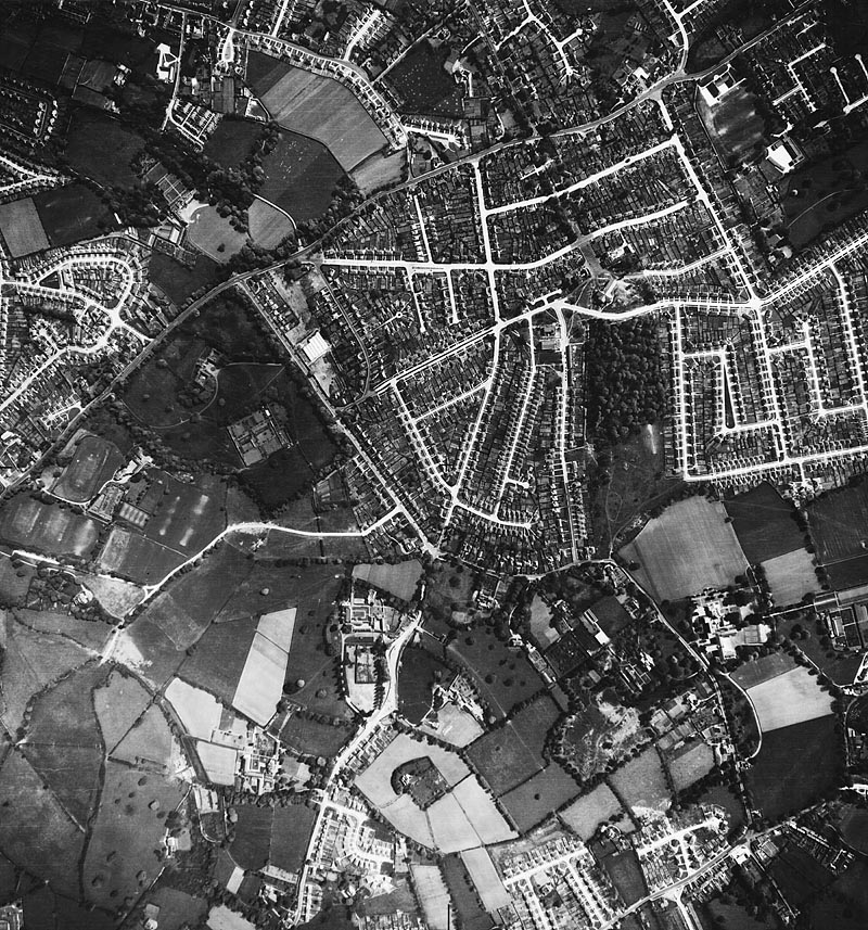
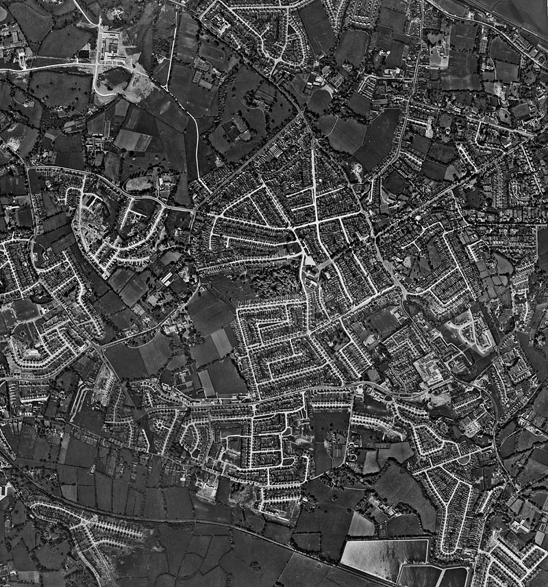
    These aerial photos show how the suburbs of South Dublin - from Dundrum on the far LHS to Blackrock including Mount Merrion and Stillorgan, developed between 1949 and 1966.
    Mount Merrion estate, begun as a "garden suburb" in the 1930s, seems to form the main nucleus around which subsequent suburban housing development takes place.

    1949
    1949_web.jpg


    1958 (image is sideways)
    1958_web.jpg


    and 1966 - this last image shows the new Stillorgan Shopping Centre under construction. There has been substantial suburban development since the first image taken in 1949. Within a decade the Stillorgan dual carrigeway would be built and you can see the reservation for the road clearly. The new Science block at UCD Belfield is also just completed.
    1966_web.jpg


  • Registered Users Posts: 5,272 ✭✭✭Deedsie


    This is an aerial shot of Nenagh, Co Tipperary. It shows the Castle Keep, Town hall & Courthouse all of which have been recently redeveloped. Also in the shot, Catholic and protestant churches, old rialto cinema & the heritage centre.

    I think its a pretty shot of my home town if I do say so myself.


  • Closed Accounts Posts: 6,084 ✭✭✭oppenheimer1


    The historic towns atlas series produced by the RIA would be the perfect material for the OP to look at.

    To date they've done 24 towns and cities in the country. They are very good and well worth a look.

    http://www.ria.ie/publications/books/research-series/irish-historic-towns-atlas.aspx


  • Moderators, Social & Fun Moderators Posts: 12,555 Mod ✭✭✭✭JupiterKid


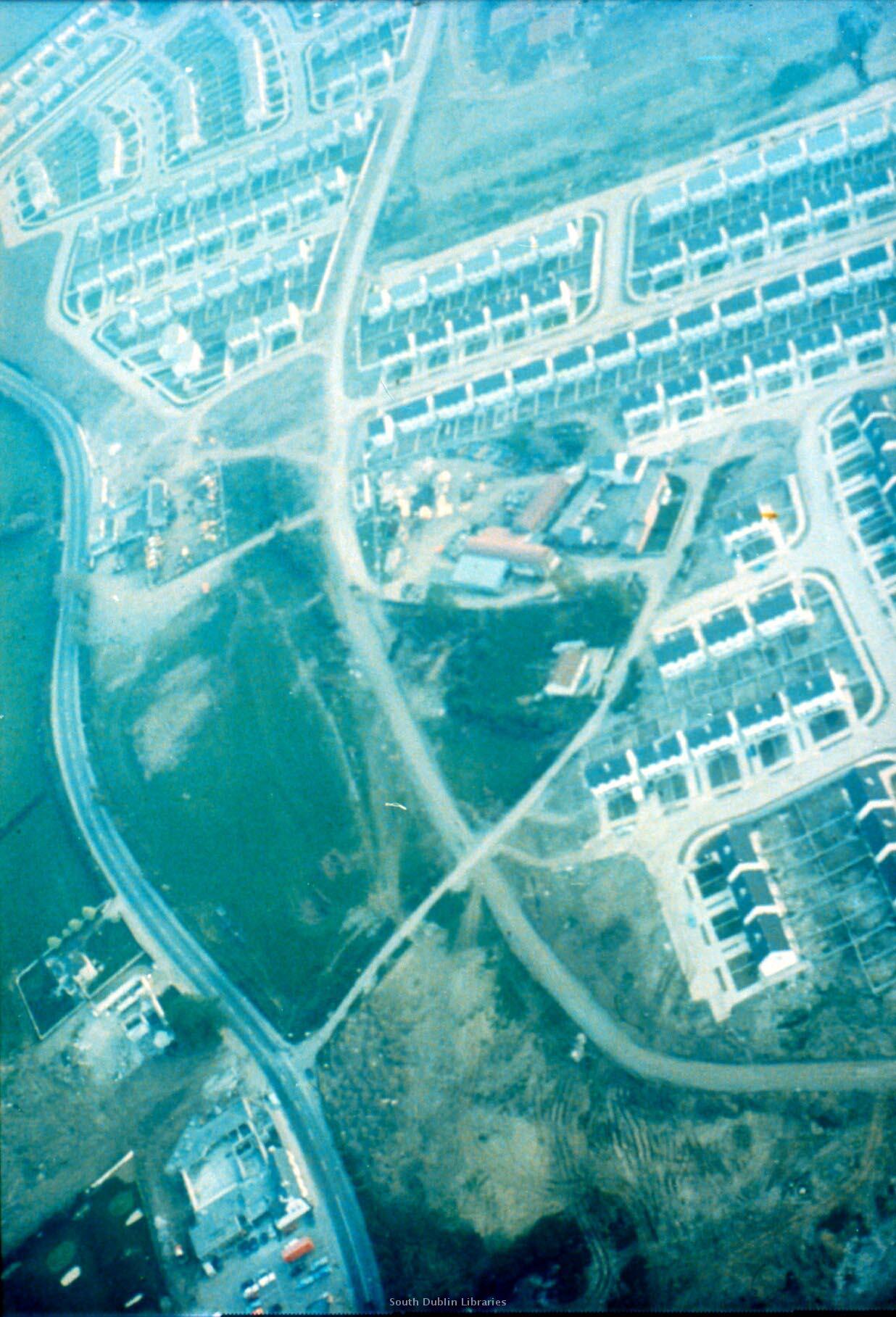
    Kilnamanagh, Tallaght under development circa 1975/76.

    Kilnamanagh comprised over 1,500 dwellings and was one of the largest purpose built housing estates in Europe at the time. The estate took several years to build and there were issues with unfinished public open spaces, amenities and roads.

    wm_1454.jpg


  • Registered Users Posts: 4,905 ✭✭✭Aard


    Loving the aerial imagery, JupiterKid. A fascinating way of documenting the growth of cities.


  • Moderators, Social & Fun Moderators Posts: 12,555 Mod ✭✭✭✭JupiterKid


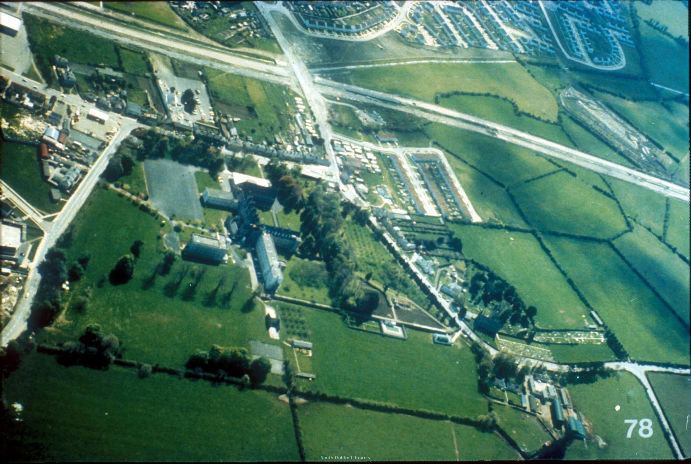
    Tallaght village looking south west, 1977. The then under construction Tallaght Bypass can be seen across the image as earthworks.

    wm_1525.jpg


  • Moderators, Social & Fun Moderators Posts: 12,555 Mod ✭✭✭✭JupiterKid


    The newly developing Cork suburb of Douglas, 1973

    Douglas-1973.jpg


    Douglas in 2005

    Douglas-2013.jpg


  • Registered Users Posts: 1,404 ✭✭✭dogmatix


    and 1966 - this last image shows the new Stillorgan Shopping Centre under construction. There has been substantial suburban development since the first image taken in 1949. Within a decade the Stillorgan dual carrigeway would be built and you can see the reservation for the road clearly. The new Science block at UCD Belfield is also just completed.
    1966_web.jpg[/QUOTE]

    Great photo! Surprised I have not come across this thread before. I can still the resevoirs, the old railway line (now the luas), my old school (Benildus) under construction, and Ballaly housing estate being built.


  • Registered Users Posts: 3,406 ✭✭✭chewed


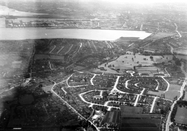
    Clontarf and Dublin Harbour, 1963

    2225643_316f8471.jpg


  • Advertisement
Advertisement